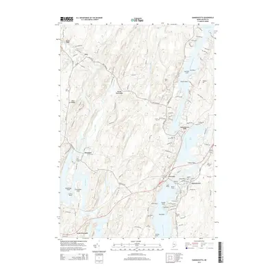
2014 Map of Damariscotta
USGS Topo · Published 2014About this map
The Damariscotta River and Sheepscot River define this coastal Maine landscape, where tidal bays and narrow inlets separate historic village centers. The interconnected waterways of Salt Bay and Damariscotta Lake meet at Damariscotta Mills, a point of significant hydrological interest where freshwater and saltwater systems interact. To the west, the winding Dyer River passes through North Newcastle and Sheepscot, reflecting a settlement pattern deeply tied to river access.
Find a feature on this map
133 named features on this map. Tap any name to fly to it.
Don’t see what you’re looking for? This feature index may not catch every label — zoom into the map to look around manually.
Map Details
Editions of this 2014 Damariscotta Map
This is the sole edition of this map. No revisions or reprints were ever made.
Other maps of this area

1893 · Wiscasset
USGS Topo · 1:62,500

1893 · Boothbay
USGS Topo · 1:62,500

1904 · Monhegan
USGS Topo · 1:62,500

1906 · Monhegan
USGS Topo · 1:62,500

1913 · Waldoboro
USGS Topo · 1:48,000

1915 · Waldoboro
USGS Topo · 1:62,500

1941 · Waldoboro
USGS Topo · 1:62,500

1941 · Boothbay
USGS Topo · 1:62,500

1943 · Boothbay
USGS Topo · 1:62,500

1944 · Wiscasset
USGS Topo · 1:62,500