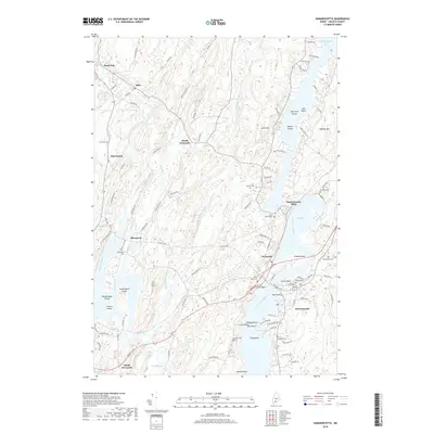
2018 Map of Damariscotta
USGS Topo · Published 2018About this map
Head Tide and Alna anchor the northern reaches of this coastal Maine landscape, where the Sheepscot River winds southward toward the tidal waters of the Marsh River. The settlement pattern follows the intricate shoreline and river valleys, connecting historical hubs like Damariscotta Mills and Newcastle. A high density of burial grounds, including Saint Patrick Cem and Sheepscot Cem, suggests a long-established community structure centered around these waterways.
Find a feature on this map
105 named features on this map. Tap any name to fly to it.
Don’t see what you’re looking for? This feature index may not catch every label — zoom into the map to look around manually.
Map Details
Editions of this 2018 Damariscotta Map
This is the sole edition of this map. No revisions or reprints were ever made.
Other maps of this area

1893 · Wiscasset
USGS Topo · 1:62,500

1893 · Boothbay
USGS Topo · 1:62,500

1904 · Monhegan
USGS Topo · 1:62,500

1906 · Monhegan
USGS Topo · 1:62,500

1913 · Waldoboro
USGS Topo · 1:48,000

1915 · Waldoboro
USGS Topo · 1:62,500

1941 · Waldoboro
USGS Topo · 1:62,500

1941 · Boothbay
USGS Topo · 1:62,500

1943 · Boothbay
USGS Topo · 1:62,500

1944 · Wiscasset
USGS Topo · 1:62,500