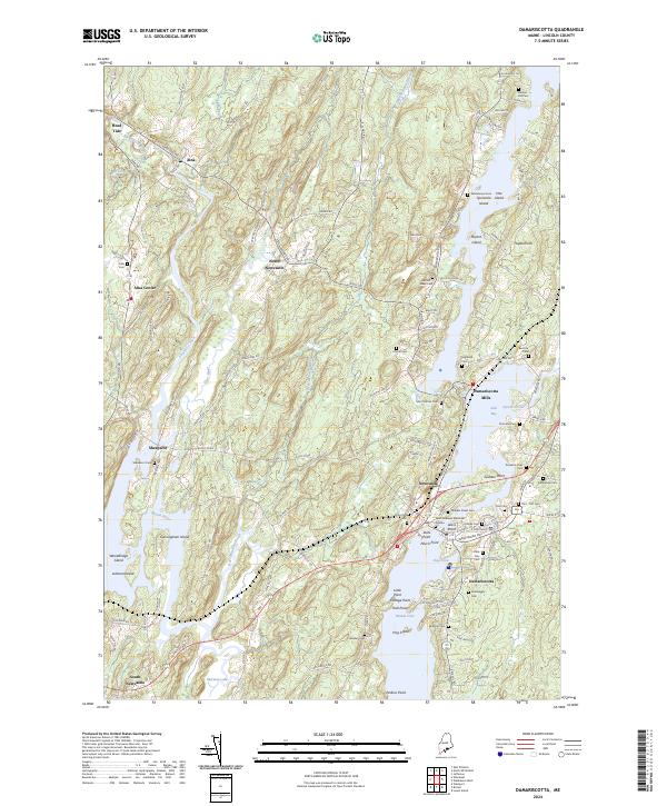
2024 Map of Damariscotta
USGS Topo · Published 2024About this map
Damariscotta Mills and the twin villages of Newcastle and Damariscotta anchor this coastal landscape where the Sheepscot River and tidal estuaries define the geography. The map reveals a dense network of family and community burial grounds, from the Saint Patricks Cem to the Sheepscot Cem, reflecting centuries of settlement along the winding riverbanks. Between the inland hamlet of Head Tide and the southern reaches of South Newcastle, the terrain is marked by significant points and islands, including Glidden Point and Cunningham Island. The proximity of Salt Bay and Oyster Creek illustrates the enduring maritime character of the area, where historical roads like Bunker Hill Rd and Ridge Rd connect these riverside communities and their shared heritage.
Find a feature on this map
135 named features on this map. Tap any name to fly to it.
Don’t see what you’re looking for? This feature index may not catch every label — zoom into the map to look around manually.
Map Details
Editions of this 2024 Damariscotta Map
This is the sole edition of this map. No revisions or reprints were ever made.
Other maps of this area

1893 · Wiscasset
USGS Topo · 1:62,500

1893 · Boothbay
USGS Topo · 1:62,500

1904 · Monhegan
USGS Topo · 1:62,500

1906 · Monhegan
USGS Topo · 1:62,500

1913 · Waldoboro
USGS Topo · 1:48,000

1915 · Waldoboro
USGS Topo · 1:62,500

1941 · Waldoboro
USGS Topo · 1:62,500

1941 · Boothbay
USGS Topo · 1:62,500

1943 · Boothbay
USGS Topo · 1:62,500

1944 · Wiscasset
USGS Topo · 1:62,500