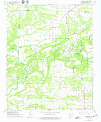
1961 Map of Damascus
USGS Topo · Published 1979About this map
Damascus sits at the junction of several rural townships near the border of Van Buren and Faulkner counties, serving as a focal point for the surrounding agricultural communities. The landscape is defined by the winding course of Cadron Creek and its many tributaries, including Cove Creek and Batesville Creek. A notable historical marker on this map is the Indian Treaty Boundary, which cuts diagonally across the terrain, reflecting the early surveying history and land partitions of the region.
Find a feature on this map
50 named features on this map. Tap any name to fly to it.
Don’t see what you’re looking for? This feature index may not catch every label — zoom into the map to look around manually.
Map Details
Editions of this 1961 Damascus Map
3 editions found
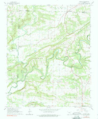
Other maps of this area

1892 · Morrillton
USGS Topo · 1:125,000

1894 · Morrillton
USGS Topo · 1:125,000

1956 · Russellville
USGS Topo · 1:250,000

1961 · Menifee
USGS Topo · 1:24,000

1961 · Conway
USGS Topo · 1:62,500

1961 · Bee Branch
USGS Topo · 1:62,500

1961 · Greenbrier
USGS Topo · 1:24,000

1961 · Bee Branch
USGS Topo · 1:24,000

1961 · Morganton
USGS Topo · 1:24,000

1961 · Damascus
USGS Topo · 1:24,000