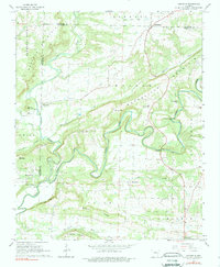
1961 Map of Damascus
USGS Topo · Published 1979About this map
Cadron Creek snakes through the center of this Arkansas landscape, defining a topography of narrow valleys and ridges where the boundaries of Van Buren, Faulkner, and Conway Counties converge. The settlement of Damascus sits in the northeast corner, while smaller rural hubs like Martinville, Republican, and Mallet Town are scattered throughout the surrounding uplands. A historical Treaty Line Boundary and the Old Indian trail trace the early human geography of the region, intersecting near the Martinville Cem. Local community life is documented through numerous landmarks, including the Pinnacle Springs Tabernacle and several rural schools and churches such as Solomon Grove Sch and Zion Grove Ch. The presence of a Fish Hatchery and a Gaging Station along the creek reflect the area's mid-century water management and conservation activities.
Find a feature on this map
57 named features on this map. Tap any name to fly to it.
Don’t see what you’re looking for? This feature index may not catch every label — zoom into the map to look around manually.
Map Details
Editions of this 1961 Damascus Map
3 editions found
Other maps of this area

1892 · Morrillton
USGS Topo · 1:125,000

1894 · Morrillton
USGS Topo · 1:125,000

1956 · Russellville
USGS Topo · 1:250,000

1961 · Menifee
USGS Topo · 1:24,000

1961 · Conway
USGS Topo · 1:62,500

1961 · Bee Branch
USGS Topo · 1:62,500

1961 · Greenbrier
USGS Topo · 1:24,000

1961 · Bee Branch
USGS Topo · 1:24,000

1961 · Morganton
USGS Topo · 1:24,000

1961 · Damascus
USGS Topo · 1:24,000