
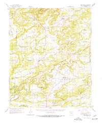
1961 Map of Bee Branch
USGS Topo · Published 1963About this map
The Pinnacle Springs Tabernacle and nearby Pinnacle Points Gap anchor this early 1960s survey of central Arkansas, where the terrain transitions through the winding waters of Cadron Creek. The map documents a landscape of small, dispersed communities like Bee Branch, Damascus, and Greenbrier, many defined by their proximity to local landmarks such as Lick Mountain and Phillips Hill.
Find a feature on this map
113 named features on this map. Tap any name to fly to it.
Don’t see what you’re looking for? This feature index may not catch every label — zoom into the map to look around manually.
Map Details
Editions of this 1961 Bee Branch Map
2 editions found
Other maps of this area

1892 · Marshall
USGS Topo · 1:125,000

1892 · Mountain View
USGS Topo · 1:125,000

1892 · Morrillton
USGS Topo · 1:125,000

1894 · Mountain View
USGS Topo · 1:125,000

1894 · Morrillton
USGS Topo · 1:125,000

1894 · Marshall
USGS Topo · 1:125,000

1901 · Marshall
USGS Topo · 1:125,000

1956 · Russellville
USGS Topo · 1:250,000

1961 · Menifee
USGS Topo · 1:24,000

1961 · Conway
USGS Topo · 1:62,500