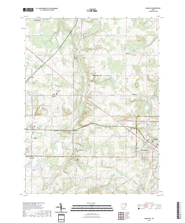
2023 Map of Damascus
USGS Topo · Published 2023About this map
Mahoning and Columbiana counties meet along a series of small agricultural and residential clusters in this recent survey. The unincorporated community of Damascus serves as a central hub, surrounded by smaller named settlements like Garfield, Beloit, and Patmos. The landscape is defined by the headwaters of several significant drainage systems, including Mill Creek, the West Branch Meander Creek, and the Middle Fork Little Beaver Creek, which flow through a mosaic of farm plots and woodlots.
Find a feature on this map
106 named features on this map. Tap any name to fly to it.
Don’t see what you’re looking for? This feature index may not catch every label — zoom into the map to look around manually.
Map Details
Editions of this 2023 Damascus Map
This is the sole edition of this map. No revisions or reprints were ever made.
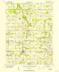
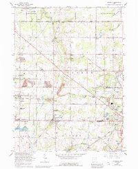
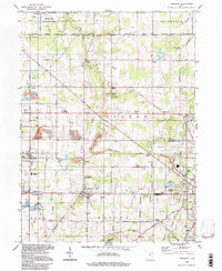
Historical Maps of Naylor Through Time
4 maps found