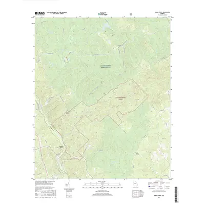
2017 Map of Dames Ferry
USGS Topo · Published 2017About this map
The Ocmulgee River serves as the dividing line between Monroe Co and Jones Co in this 2017 survey, where the crossing at Dames Ferry remains a central point of interest. The southern portion of the map is defined by the heavy conservation of the Piedmont National Wildlife Refuge and the Oconee National Forest, creating a landscape dominated by forest service roads and timber management. Modern infrastructure like the S A Hodge Senior Bridge spans the river, replacing older crossing methods while maintaining the historic name of the settlement.
Find a feature on this map
55 named features on this map. Tap any name to fly to it.
Don’t see what you’re looking for? This feature index may not catch every label — zoom into the map to look around manually.
Map Details
Editions of this 2017 Dames Ferry Map
This is the sole edition of this map. No revisions or reprints were ever made.
Other maps of this area

1951 · Forsyth
USGS Topo · 1:62,500

1953 · Athens
USGS Topo · 1:250,000

1956 · Bolingbroke
USGS Topo · 1:62,500

1956 · Macon
USGS Topo · 1:62,500

1957 · Macon
USGS Topo · 1:250,000

1958 · Macon
USGS Topo · 1:250,000

1958 · Athens
USGS Topo · 1:250,000

1959 · Athens
USGS Topo · 1:250,000

1963 · Athens
USGS Topo · 1:250,000

1964 · Macon
USGS Topo · 1:250,000