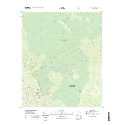
2020 Map of Dames Ferry
USGS Topo · Published 2020About this map
Piedmont National Wildlife Refuge and the Oconee National Forest dominate this Central Georgia landscape, where dense woodlands are bisected by numerous waterways and hiking trails. The settlement of Dames Ferry sits near the Ocmulgee River, connected to the surrounding countryside by the S A Hodge Senior Bridge and a network of gravel and forest roads. Further east, the small crossroads of Five Points serves as a local landmark within the refuge boundaries.
Find a feature on this map
62 named features on this map. Tap any name to fly to it.
Don’t see what you’re looking for? This feature index may not catch every label — zoom into the map to look around manually.
Map Details
Editions of this 2020 Dames Ferry Map
This is the sole edition of this map. No revisions or reprints were ever made.
Other maps of this area

1951 · Forsyth
USGS Topo · 1:62,500

1953 · Athens
USGS Topo · 1:250,000

1956 · Bolingbroke
USGS Topo · 1:62,500

1956 · Macon
USGS Topo · 1:62,500

1957 · Macon
USGS Topo · 1:250,000

1958 · Macon
USGS Topo · 1:250,000

1958 · Athens
USGS Topo · 1:250,000

1959 · Athens
USGS Topo · 1:250,000

1963 · Athens
USGS Topo · 1:250,000

1964 · Macon
USGS Topo · 1:250,000