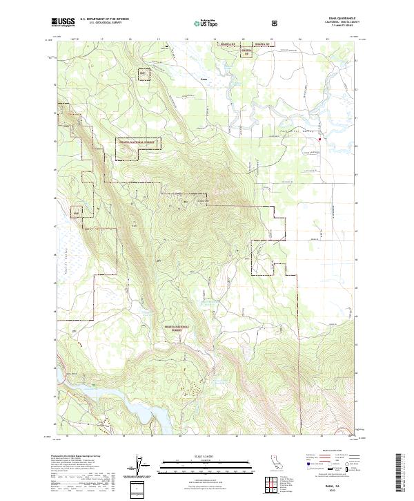
2022 Map of Dana
USGS Topo · Published 2022About this map
Fall River Valley serves as a distinct low-lying contrast to the surrounding highlands of the Shasta National Forest. This landscape is defined by its complex water management and storage, featuring several high-altitude catchments like Coyote Flat Reservoir, Soldier Mountain Reservoir, and Warner Grade Reservoir. These water bodies and their connecting streams, such as Soldier Cr, illustrate the intricate drainage patterns that feed into the larger Fall River and eventually Lake Britton at the southern edge of the quadrangle.
Find a feature on this map
52 named features on this map. Tap any name to fly to it.
Don’t see what you’re looking for? This feature index may not catch every label — zoom into the map to look around manually.
Map Details
Editions of this 2022 Dana Map
This is the sole edition of this map. No revisions or reprints were ever made.
Other maps of this area

1886 · Lassen Peak
USGS Topo · 1:250,000

1886 · Modoc Lava Bed
USGS Topo · 1:250,000

1892 · Modoc Lava-Bed
USGS Topo · 1:250,000

1892 · Lassen Peak
USGS Topo · 1:250,000

1894 · Lassen Peak
USGS Topo · 1:250,000

1932 · Bartle
USGS Topo · 1:96,000

1935 · Burney
USGS Topo · 1:96,000

1939 · Burney
USGS Topo · 1:125,000

1939 · Halls Flat
USGS Topo · 1:125,000

1939 · Bartle
USGS Topo · 1:125,000