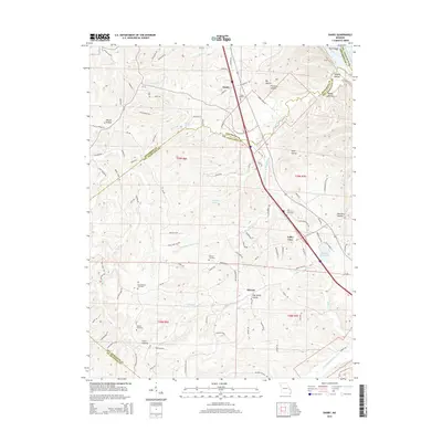
2015 Map of Danby
USGS Topo · Published 2015About this map
Mississippi River frontage along the northeastern edge of this Missouri survey gives way to a complex landscape of hollows and ridges defined by the Isle du Bois Cr drainage system. The settlement at Danby serves as a central point in this rural area, which straddles the borders of Jefferson, Ste. Genevieve, and St. Francois counties. The map captures a high density of small family and community burial grounds, including Baker Cemetery, Concord Cemetery, and Hoover Cemetery, providing significant points of interest for genealogical research in these townships. Terrain features like Hocum Hollow and Wolf Hollow emphasize the deeply dissected topography of the region. Notable water sources such as Skagas Spring and Corbin Lake are located west of the Interstate 55 corridor, which bisects the quadrangle as it passes near Valley View and south toward Kinsey.
Find a feature on this map
106 named features on this map. Tap any name to fly to it.
Don’t see what you’re looking for? This feature index may not catch every label — zoom into the map to look around manually.
Map Details
Editions of this 2015 Danby Map
This is the sole edition of this map. No revisions or reprints were ever made.
Other maps of this area

1904 · Farmington
USGS Topo · 1:62,500

1906 · Farmington
USGS Topo · 1:62,500

1907 · Weingarten
USGS Topo · 1:62,500

1909 · Weingarten
USGS Topo · 1:62,500

1915 · Renault
USGS Topo · 1:62,500

1915 · Crystal City
USGS Topo · 1:62,500

1940 · Renault
USGS Topo · 1:62,500

1949 · Saint Louis
USGS Topo · 1:250,000

1949 · Rolla
USGS Topo · 1:250,000

1949 · Crystal City
USGS Topo · 1:62,500