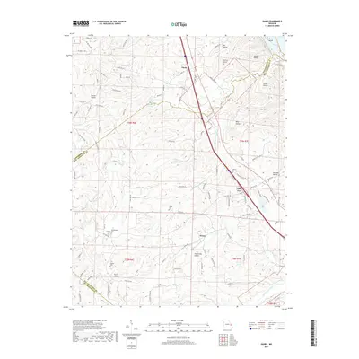
2017 Map of Danby
USGS Topo · Published 2017About this map
Danby and the surrounding hills of the Missouri Rhineland region are defined by a complex drainage system feeding into the Isle du Bois Creek. This modern survey reveals a landscape where historical burial grounds like Baker Cem and Concord Cem remain preserved alongside newer developments such as Valley View. The terrain is deeply incised by numerous named hollows, including Big Hollow and Hog Spring Hollow, which dictate the winding paths of rural routes like State HWY TT. Genealogical interest is particularly high here, with family-named landmarks and small cemeteries like Moeller Cem and Cindy LN Cem appearing near the settlement of Kinsey. The map also details the hydrology of the area, from the waters of Corbin Lake to the flow of Dry Fork and the South Fork Isle du Bois Creek.
Find a feature on this map
105 named features on this map. Tap any name to fly to it.
Don’t see what you’re looking for? This feature index may not catch every label — zoom into the map to look around manually.
Map Details
Editions of this 2017 Danby Map
This is the sole edition of this map. No revisions or reprints were ever made.
Other maps of this area

1904 · Farmington
USGS Topo · 1:62,500

1906 · Farmington
USGS Topo · 1:62,500

1907 · Weingarten
USGS Topo · 1:62,500

1909 · Weingarten
USGS Topo · 1:62,500

1915 · Renault
USGS Topo · 1:62,500

1915 · Crystal City
USGS Topo · 1:62,500

1940 · Renault
USGS Topo · 1:62,500

1949 · Saint Louis
USGS Topo · 1:250,000

1949 · Rolla
USGS Topo · 1:250,000

1949 · Crystal City
USGS Topo · 1:62,500