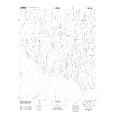
2011 Map of Dane Canyon
USGS Topo · Published 2011About this map
Holder Cabin and Buck Springs Cabin sit within a high-elevation landscape defined by the Mogollon Rim's intricate drainage systems. This 2011 survey illustrates a network of named springs and draws that supported early cattle ranching and homesteading, including Pinchot Spring, McClintock Spring, and Barbershop Spring. The terrain is characterized by steep ridges and deep canyons, most notably Dane Canyon and Fred Haught Canyon, which are framed by landforms like Buck Springs Ridge and Hospital Ridge. The southern edge of the map follows the winding Rim Rd, a critical transit corridor along the edge of the plateau. Notable water features such as Dude Lake and the upper reaches of Bonita Creek underscore the importance of water management in this arid environment, marked further by artificial catchments like Yeager Tank and Nonsuitable Tank.
Find a feature on this map
69 named features on this map. Tap any name to fly to it.
Don’t see what you’re looking for? This feature index may not catch every label — zoom into the map to look around manually.
Map Details
Editions of this 2011 Dane Canyon Map
This is the sole edition of this map. No revisions or reprints were ever made.
Other maps of this area

1887 · Verde
USGS Topo · 1:250,000

1892 · Verde
USGS Topo · 1:250,000

1934 · Pine
USGS Topo · 1:62,500

1934 · Promontory Butte
USGS Topo · 1:62,500

1939 · Promontory Butte
USGS Topo · 1:62,500

1940 · Pine
USGS Topo · 1:62,500

1952 · Pine
USGS Topo · 1:62,500

1952 · Promontory Butte
USGS Topo · 1:62,500

1954 · Holbrook
USGS Topo · 1:250,000

1957 · Holbrook
USGS Topo · 1:250,000