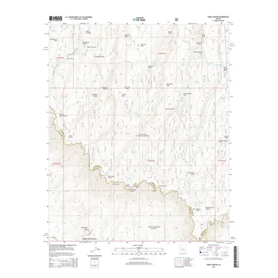
2014 Map of Dane Canyon
USGS Topo · Published 2014About this map
The Mogollon Rim forms the dramatic centerpiece of this high-country survey, marking the geological boundary between the Coconino National Forest and Tonto National Forest. This escarpment defines the drainage patterns of the region, where waters gather in remote basins like Dude Lake or flow through deeply cut incisions such as Barbershop Canyon and Hells Gate Canyon. Near the southern edge, the residential development of Bonita Creek Estates sits at the base of these heights, linked by local routes like Fire Control Rd. The landscape is a network of named springs, including McFarland Springs and Fred Haught Spring, which have long served as vital water sources in the arid Arizona uplands. The Arizona National Scenic Trail winds through the northern sections, crossing ridges such as Battleground Ridge and Turkey Pen Ridge, illustrating the area's evolution from a timber and ranching frontier into a premier recreational corridor.
Find a feature on this map
83 named features on this map. Tap any name to fly to it.
Don’t see what you’re looking for? This feature index may not catch every label — zoom into the map to look around manually.
Map Details
Editions of this 2014 Dane Canyon Map
This is the sole edition of this map. No revisions or reprints were ever made.
Other maps of this area

1887 · Verde
USGS Topo · 1:250,000

1892 · Verde
USGS Topo · 1:250,000

1934 · Pine
USGS Topo · 1:62,500

1934 · Promontory Butte
USGS Topo · 1:62,500

1939 · Promontory Butte
USGS Topo · 1:62,500

1940 · Pine
USGS Topo · 1:62,500

1952 · Pine
USGS Topo · 1:62,500

1952 · Promontory Butte
USGS Topo · 1:62,500

1954 · Holbrook
USGS Topo · 1:250,000

1957 · Holbrook
USGS Topo · 1:250,000