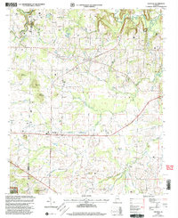
2000 Map of Danville
USGS Topo · Published 2003About this map
Danville serves as the focal point for this rural landscape at the turn of the millennium, situated along the Lawrence and Morgan County line. The topography is defined by significant elevations such as Owen Mountain and Isabel Mountain, while the northern reach is shaped by the backwaters of Wheeler Lake and the meandering Flint Creek. A dense network of smaller waterways including No Business Creek, Crowdabout Creek, and Johnson Chapel Creek drains the surrounding terrain, which includes portions of the William B. Bankhead National Forest.
Find a feature on this map
51 named features on this map. Tap any name to fly to it.
Don’t see what you’re looking for? This feature index may not catch every label — zoom into the map to look around manually.
Map Details
Editions of this 2000 Danville Map
This is the sole edition of this map. No revisions or reprints were ever made.
Other maps of this area

1888 · Cullman
USGS Topo · 1:125,000

1888 · Huntsville
USGS Topo · 1:125,000

1892 · Cullman
USGS Topo · 1:125,000

1892 · Huntsville
USGS Topo · 1:125,000

1927 · Falkville
USGS Topo · 1:24,000

1935 · Upshaw
USGS Topo · 1:24,000

1935 · Danville
USGS Topo · 1:48,000

1935 · Oakville
USGS Topo · 1:24,000

1936 · Caddo
USGS Topo · 1:24,000

1936 · Mc Kendry
USGS Topo · 1:24,000