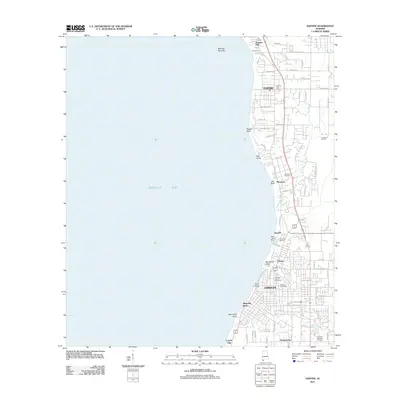
2011 Map of Daphne
USGS Topo · Published 2011About this map
Mobile Bay defines the western edge of this coastal landscape, where the eastern shore’s high bluffs and deep gullies meet the water. The suburban growth of the early 21st century is evident in the street networks of Daphne and Fairhope, yet the map preserves the names of smaller historic communities like Seacliff, Volanta, and Houstonville. For genealogists, the sheet documents important burial grounds including Montrose Cemetery and the Fairhope Colony Cemetery. The terrain is marked by distinctive hydrological features like Fly Creek and Rock Creek, alongside geological landmarks such as Red Bluff and Big Mouth Gully. The presence of the Brantley 1 Dirt Pit and the specialized Fly Creek Marina reflect the local economy’s mix of resource extraction and maritime recreation. This survey captures a moment of transition where the natural ravines and the legendary Jackson Oak stand alongside modern infrastructure like the Daphne Post Office.
Find a feature on this map
72 named features on this map. Tap any name to fly to it.
Don’t see what you’re looking for? This feature index may not catch every label — zoom into the map to look around manually.
Map Details
Editions of this 2011 Daphne Map
This is the sole edition of this map. No revisions or reprints were ever made.
Other maps of this area

1921 · Point Clear
USGS Topo · 1:62,500

1921 · Fairhope
USGS Topo · 1:62,500

1921 · Delchamps
USGS Topo · 1:62,500

1922 · Mobile
USGS Topo · 1:62,500

1939 · Daphne
USGS Topo · 1:31,680

1940 · Silverhill
USGS Topo · 1:31,680

1940 · Hollingers Island
USGS Topo · 1:31,680

1940 · Mobile
USGS Topo · 1:31,680

1940 · Mobile
USGS Topo · 1:62,500

1941 · Daphne
USGS Topo · 1:31,680