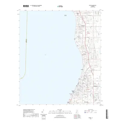
2018 Map of Daphne
USGS Topo · Published 2018About this map
Daphne and Fairhope anchor this 2018 survey of the Eastern Shore, illustrating the modern residential and commercial density along the high bluffs overlooking Mobile Bay. The map captures a sophisticated network of local roads and planned developments that have transformed the coastal landscape, yet older markers remain, such as the Jackson Oak in the north and the Montrose Cem further south. The topography is defined by sharp erosion features like Red Gully, Stack Gully, and Big Mouth Gully, which cut through the elevated shoreline toward the bay. These drainages separate distinct communities such as Montrose, Seacliff, and Volanta. Further inland, the transition from coastal bluffs to low-lying areas is marked by Titi Swamp and the headwaters of Rock Cr, showing the complex drainage patterns that continue to influence the growth of Houstonville and Loyola Villa.
Find a feature on this map
86 named features on this map. Tap any name to fly to it.
Don’t see what you’re looking for? This feature index may not catch every label — zoom into the map to look around manually.
Map Details
Editions of this 2018 Daphne Map
This is the sole edition of this map. No revisions or reprints were ever made.
Other maps of this area

1921 · Point Clear
USGS Topo · 1:62,500

1921 · Fairhope
USGS Topo · 1:62,500

1921 · Delchamps
USGS Topo · 1:62,500

1922 · Mobile
USGS Topo · 1:62,500

1939 · Daphne
USGS Topo · 1:31,680

1940 · Silverhill
USGS Topo · 1:31,680

1940 · Hollingers Island
USGS Topo · 1:31,680

1940 · Mobile
USGS Topo · 1:31,680

1940 · Mobile
USGS Topo · 1:62,500

1941 · Daphne
USGS Topo · 1:31,680