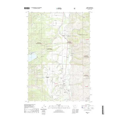
2020 Map of Darby
USGS Topo · Published 2020About this map
The Bitterroot River carves through the heart of Ravalli County, anchoring a landscape where mountain wilderness meets the structured valley floor. The town of Darby serves as a primary hub near the southern reaches of the map, situated amidst a network of irrigation and transport that includes the Bitterroot River Bridge and Tin Cup Creek Bridge. To the north, the small settlement of Como and the residential area at University Heights highlight the ongoing habitation of the valley, while the Lone Pine Cem preserves the memory of earlier generations.
Find a feature on this map
94 named features on this map. Tap any name to fly to it.
Don’t see what you’re looking for? This feature index may not catch every label — zoom into the map to look around manually.
Map Details
Editions of this 2020 Darby Map
This is the sole edition of this map. No revisions or reprints were ever made.
Other maps of this area

1901 · Hamilton
USGS Topo · 1:125,000

1956 · Elk City
USGS Topo · 1:250,000

1956 · Hamilton
USGS Topo · 1:250,000

1959 · Hamilton
USGS Topo · 1:250,000

1960 · Elk City
USGS Topo · 1:250,000

1960 · Hamilton
USGS Topo · 1:250,000

1964 · Hamilton
USGS Topo · 1:250,000

1964 · Hamilton South
USGS Topo · 1:24,000

1964 · Burnt Ridge
USGS Topo · 1:24,000

1964 · Darby
USGS Topo · 1:24,000