
1964 Map of Hamilton South
USGS Topo · Published 1968About this map
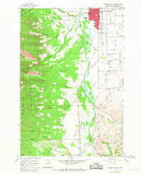
The Bitterroot River valley south of Hamilton is defined here by an intricate network of water management and transportation. The Northern Pacific railroad tracks run parallel to the river, serving the agricultural and timber interests of the mid-1960s. The landscape transition from the irrigated flats of the Bitterroot Irrigation District Canal to the steep eastern slopes of the Bitterroot National Forest is stark, with Ward Mountain and Goat Mountain towering over the canyon mouths. Residential and civic development is concentrated in the north, where schools like Washington Sch and Jefferson Sch anchor the Hamilton townsite.
Find a feature on this map
44 named features on this map. Tap any name to fly to it.
Don’t see what you’re looking for? This feature index may not catch every label — zoom into the map to look around manually.
Map Details
Editions of this 1964 Hamilton South Map
2 editions found
Other maps of this area

1901 · Hamilton
USGS Topo · 1:125,000

1956 · Hamilton
USGS Topo · 1:250,000

1959 · Hamilton
USGS Topo · 1:250,000

1960 · Hamilton
USGS Topo · 1:250,000

1964 · Hamilton
USGS Topo · 1:250,000

1964 · Darby
USGS Topo · 1:24,000

1964 · Ward Mountain
USGS Topo · 1:24,000
1964 · Como Peaks
USGS Topo · 1:24,000
1964 · Deer Mountain
USGS Topo · 1:24,000
1964 · Mountain House
USGS Topo · 1:24,000
Featured Places
- Hamilton, MT
- Grantsdale, MT
- Big Sky Mobile Home Park, MT
- Charlos Heights, MT
- Hamilton Mobile Home Park, MT