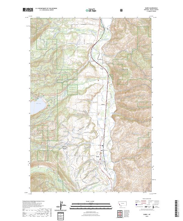
2024 Map of Darby
USGS Topo · Published 2024About this map
The Bitterroot River valley serves as the central corridor for this Montana landscape, where the town of Darby and the small settlements of Como and Gorus are positioned between the towering Bitterroot Mountains to the west and the Sapphire Mountains to the east. Extensive sections of the Bitterroot National Forest dominate the topography, encompassing landmarks such as Lake Como and Shannon Lake. The area's development is reflected in the residential layout of University Heights and the network of canyon roads like Coal Mine Rd and Lost Horse Rd that penetrate the mountain drainages.
Find a feature on this map
85 named features on this map. Tap any name to fly to it.
Don’t see what you’re looking for? This feature index may not catch every label — zoom into the map to look around manually.
Map Details
Editions of this 2024 Darby Map
This is the sole edition of this map. No revisions or reprints were ever made.
Other maps of this area

1901 · Hamilton
USGS Topo · 1:125,000

1956 · Elk City
USGS Topo · 1:250,000

1956 · Hamilton
USGS Topo · 1:250,000

1959 · Hamilton
USGS Topo · 1:250,000

1960 · Elk City
USGS Topo · 1:250,000

1960 · Hamilton
USGS Topo · 1:250,000

1964 · Hamilton
USGS Topo · 1:250,000

1964 · Hamilton South
USGS Topo · 1:24,000

1964 · Burnt Ridge
USGS Topo · 1:24,000

1964 · Darby
USGS Topo · 1:24,000