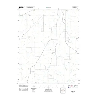
2011 Map of Darien
USGS Topo · Published 2011About this map
The Dent County Farm and the Salem Memorial Airport anchor the northern reaches of this Dent County landscape, where small crossroads communities and family burial grounds dot the rural terrain. Scattered settlements including Darien, New Hope, Jack, and Custer are linked by an extensive network of county roads, such as Co RD-612 and Co RD-638, which follow the natural drainage of the Ozark foothills. For those tracing local heritage, the map identifies several significant resting places including Love Cemetery, Stagner Cemetery, and Cage-Lane Cemetery. The drainage pattern is defined by winding waterways like Spring Creek, Holt Creek, and Gladden Branch, illustrating a topography where historical settlement was dictated by the proximity to reliable water sources and the rise of local aviation and agricultural centers.
Find a feature on this map
49 named features on this map. Tap any name to fly to it.
Don’t see what you’re looking for? This feature index may not catch every label — zoom into the map to look around manually.
Map Details
Editions of this 2011 Darien Map
This is the sole edition of this map. No revisions or reprints were ever made.
Other maps of this area

1932 · Cedar Grove
USGS Topo · 1:48,000

1941 · Salem
USGS Topo · 1:62,500

1941 · Stone Hill
USGS Topo · 1:62,500

1945 · Salem
USGS Topo · 1:62,500

1945 · Stone Hill
USGS Topo · 1:62,500

1945 · Round Spring
USGS Topo · 1:62,500

1947 · Sinkin
USGS Topo · 1:48,000

1949 · Round Spring
USGS Topo · 1:62,500

1949 · Rolla
USGS Topo · 1:250,000

1951 · Montauk
USGS Topo · 1:24,000