
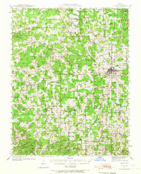
1941 Map of Salem
USGS Topo · Published 1956About this map
Salem serves as the focal point of this early 1940s landscape, positioned as a central hub for the surrounding rural communities of Dent County. The map reveals a dense network of country schools and churches that defined Ozark social life during this era, including New Harmony M E Ch, Round Pond Ch, and West Shady Grove Sch. The presence of several "banks," such as Lennox Bank, Blank Bank, and Clanky Bank, points toward the region's history of iron ore extraction, which shaped the local economy alongside timber and farming.
Find a feature on this map
88 named features on this map. Tap any name to fly to it.
Don’t see what you’re looking for? This feature index may not catch every label — zoom into the map to look around manually.
Map Details
Editions of this 1941 Salem Map
2 editions found
Other maps of this area

1912 · Rolla
USGS Topo · 1:62,500

1928 · Meramec Spring
USGS Topo · 1:62,500

1932 · Steelville
USGS Topo · 1:48,000

1932 · Cedar Grove
USGS Topo · 1:48,000

1933 · Steelville
USGS Topo · 1:62,500

1937 · Steelville
USGS Topo · 1:62,500

1937 · Edgar Springs
USGS Topo · 1:48,000

1941 · Stone Hill
USGS Topo · 1:62,500

1945 · Salem
USGS Topo · 1:62,500

1945 · Edgar Springs
USGS Topo · 1:62,500