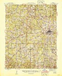
1945 Map of Salem
USGS Topo · Published 1945About this map
Salem serves as the focal point of this Dent County landscape, situated at the junction of Highway 32, Highway 72, and Highway 19. The town's connection to regional commerce is marked by the St. Louis-San Francisco RR line, which terminates in the heart of the settlement near the Sewage Disposal plant and the County Farm. The surrounding terrain is defined by a dense network of hollows, such as Headarch Hollow and Houston Hollow, which drain into systems like Spring Creek and Dry Fork.
Find a feature on this map
93 named features on this map. Tap any name to fly to it.
Don’t see what you’re looking for? This feature index may not catch every label — zoom into the map to look around manually.
Map Details
Editions of this 1945 Salem Map
2 editions found
Other maps of this area

1912 · Rolla
USGS Topo · 1:62,500

1928 · Meramec Spring
USGS Topo · 1:62,500

1932 · Steelville
USGS Topo · 1:48,000

1932 · Cedar Grove
USGS Topo · 1:48,000

1933 · Steelville
USGS Topo · 1:62,500

1937 · Steelville
USGS Topo · 1:62,500

1937 · Edgar Springs
USGS Topo · 1:48,000

1941 · Salem
USGS Topo · 1:62,500

1941 · Stone Hill
USGS Topo · 1:62,500

1945 · Salem
USGS Topo · 1:62,500