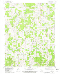
1981 Map of Darien
USGS Topo · Published 1982About this map
The tiny settlement of Darien anchor this portion of the Ozark Plateau in Dent County, Missouri, during the early 1980s. The landscape is a network of small upland communities and rural landmarks, including the Salem Memorial Airfield and the Oak Hill R-I Sch. The terrain is deeply etched by watercourses such as Spring Creek and Dry Fork, with an Old Railroad Grade in the northeast corner testifying to the region's earlier timber and transport history. Genealogists will find significant value in several family-named burial grounds, including Love Cem, Stagner Cem, and Cage-Lane Cem. The area’s religious and industrial character is preserved through markers for the Full Gospel Temple, New Hope Ch, and a specific Mine location. This survey documents the intersection of rural infrastructure, from a significant Pipeline to the Salem Apostolic Ch, during a period of established agricultural and local utility development.
Find a feature on this map
29 named features on this map. Tap any name to fly to it.
Don’t see what you’re looking for? This feature index may not catch every label — zoom into the map to look around manually.
Map Details
Editions of this 1981 Darien Map
This is the sole edition of this map. No revisions or reprints were ever made.
Other maps of this area

1932 · Cedar Grove
USGS Topo · 1:48,000

1941 · Salem
USGS Topo · 1:62,500

1941 · Stone Hill
USGS Topo · 1:62,500

1945 · Salem
USGS Topo · 1:62,500

1945 · Stone Hill
USGS Topo · 1:62,500

1945 · Round Spring
USGS Topo · 1:62,500

1947 · Sinkin
USGS Topo · 1:48,000

1949 · Round Spring
USGS Topo · 1:62,500

1949 · Rolla
USGS Topo · 1:250,000

1951 · Montauk
USGS Topo · 1:24,000