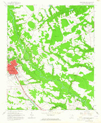
1963 Map of Darlington East
USGS Topo · Published 1965About this map
Black Creek snakes through the center of this South Carolina landscape, defining the transition between the urban grid of Darlington and the agricultural lands to the east. The city's eastern edge is marked by Williamson Park and the winding streets around Grove Hill Cem, while the industrial and transport character of the era is evident in the convergence of the Atlantic Coast Line and Seaboard Air Line railroads.
Find a feature on this map
53 named features on this map. Tap any name to fly to it.
Don’t see what you’re looking for? This feature index may not catch every label — zoom into the map to look around manually.
Map Details
Editions of this 1963 Darlington East Map
2 editions found
Other maps of this area

1940 · Florence West
USGS Topo · 1:62,500

1940 · Florence East
USGS Topo · 1:62,500

1943 · Gum Swamp
USGS Topo · 1:62,500

1945 · Florence East
USGS Topo · 1:62,500

1945 · Florence West
USGS Topo · 1:62,500

1953 · Florence
USGS Topo · 1:250,000

1954 · Florence
USGS Topo · 1:250,000

1963 · Dovesville
USGS Topo · 1:24,000

1963 · Mont Clare
USGS Topo · 1:24,000

1963 · Darlington East
USGS Topo · 1:24,000