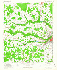
1963 Map of Darlington West
USGS Topo · Published 1965About this map
Darlington serves as the focal point of this South Carolina survey, appearing as a significant rail and commercial hub just before mid-century growth patterns shifted. The city is defined by the intersection of the Atlantic Coast Line and Seaboard Air Line railroads, which facilitated the region's agricultural economy. A notable landmark on the western edge of town is the Darlington Raceway, already a prominent feature by the early 1960s. The surrounding landscape is a network of small crossroads settlements such as Lewis Crossroads and Earlys Crossroads, connected by rural routes that trace the undulating terrain between Swift Creek and Indian Creek. Genealogists will find numerous family-named burial sites, including Flowers Cem and Bryant Cem, while industrial traces like a Claypit and a Borrow Pit indicate local resource extraction during this era.
Find a feature on this map
56 named features on this map. Tap any name to fly to it.
Don’t see what you’re looking for? This feature index may not catch every label — zoom into the map to look around manually.
Map Details
Editions of this 1963 Darlington West Map
2 editions found

Other maps of this area

1940 · Florence West
USGS Topo · 1:62,500

1941 · Spartanburg
USGS Topo · 1:250,000

1945 · Florence West
USGS Topo · 1:62,500

1953 · Florence
USGS Topo · 1:250,000

1953 · Spartanburg
USGS Topo · 1:250,000

1954 · Florence
USGS Topo · 1:250,000

1960 · Spartanburg
USGS Topo · 1:250,000

1963 · Spartanburg
USGS Topo · 1:250,000

1963 · Dovesville
USGS Topo · 1:24,000

1963 · Mont Clare
USGS Topo · 1:24,000