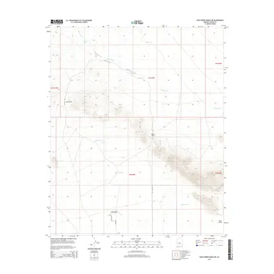
2014 Map of Date Creek Ranch SW
USGS Topo · Published 2014About this map
Flying Dare's Ranch Airport serves as a lone modern landmark in this arid expanse of Yavapai County, situated at the edge of the Aguila Valley. The landscape is defined by its drainages and mountain crossings, notably Bullard Pass and Rudy Pass, which negotiate the high ground between the valley floor and the surrounding ridges. Water management is the primary sign of human adaptation here, evidenced by a series of catchment features such as Eight Tank, Sixteen Tank, and the named Harcúvar Tank located near the southern reaches. These tanks, along with Bullard Wash, indicate the vital role of seasonal water flow in this desert environment. Small-scale infrastructure like Eagle Eye Ave and W Smith Rd provide localized access to this remote corner of Arizona during the early 21st century.
Find a feature on this map
21 named features on this map. Tap any name to fly to it.
Don’t see what you’re looking for? This feature index may not catch every label — zoom into the map to look around manually.
Map Details
Editions of this 2014 Date Creek Ranch SW Map
This is the sole edition of this map. No revisions or reprints were ever made.
Other maps of this area

1923 · Signal
USGS Topo · 1:250,000

1942 · Signal
USGS Topo · 1:250,000

1942 · Vicksburg
USGS Topo · 1:250,000

1950 · Prescott
USGS Topo · 1:250,000

1954 · Prescott
USGS Topo · 1:250,000

1954 · Phoenix
USGS Topo · 1:250,000

1957 · Phoenix
USGS Topo · 1:250,000

1958 · Prescott
USGS Topo · 1:250,000

1958 · Phoenix
USGS Topo · 1:250,000

1959 · Prescott
USGS Topo · 1:250,000