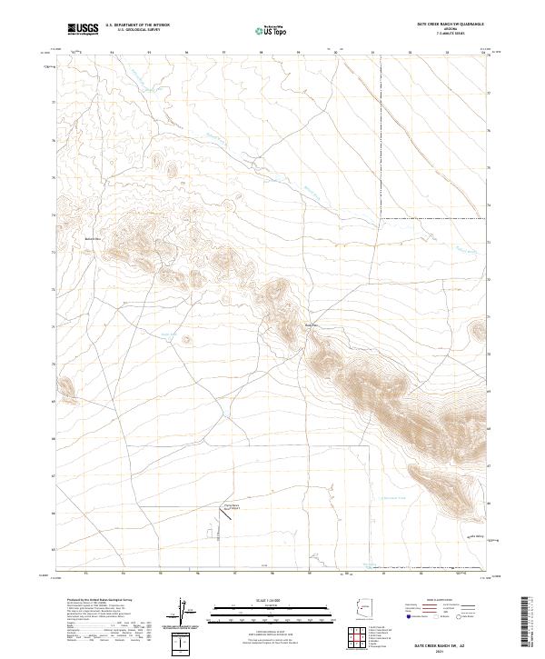
2021 Map of Date Creek Ranch SW
USGS Topo · Published 2021About this map
Flying Dare's Ranch Airport serves as a modern waypoint in this desert landscape, located just north of the Co RD corridor in the south-central portion of the quadrangle. The terrain is defined by the drainage of Bullard Wash, which carries seasonal runoff through the gap between Bullard Pass and Rudy Pass. Water management for ranching and local utility is evidenced by a network of scattered catchments, including Holder Tank, East Tank, and Eight Tank. To the southeast, the land opens into the Aguila Valley, where the elevation drops and the rugged ridges give way to more level plains. This 2021 survey illustrates how modern infrastructure like Rider Rd integrates with the natural topography and established water features such as Harcuvar Tank.
Find a feature on this map
18 named features on this map. Tap any name to fly to it.
Don’t see what you’re looking for? This feature index may not catch every label — zoom into the map to look around manually.
Map Details
Editions of this 2021 Date Creek Ranch SW Map
This is the sole edition of this map. No revisions or reprints were ever made.
Other maps of this area

1923 · Signal
USGS Topo · 1:250,000

1942 · Signal
USGS Topo · 1:250,000

1942 · Vicksburg
USGS Topo · 1:250,000

1950 · Prescott
USGS Topo · 1:250,000

1954 · Prescott
USGS Topo · 1:250,000

1954 · Phoenix
USGS Topo · 1:250,000

1957 · Phoenix
USGS Topo · 1:250,000

1958 · Prescott
USGS Topo · 1:250,000

1958 · Phoenix
USGS Topo · 1:250,000

1959 · Prescott
USGS Topo · 1:250,000