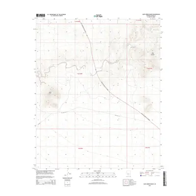
2014 Map of Date Creek Ranch
USGS Topo · Published 2014About this map
Date Creek Ranch sits at the heart of this desert landscape, where the seasonal waters of Date Creek thread through the terrain. The topography is defined by the prominent Black Mountain to the west and the rising slopes of the Date Creek Mountains in the northeast. This 2014 survey illustrates a region largely characterized by its vast open stretches and a sparse road network. The Joshua Tree Forest Pky of Arizona cuts diagonally across the quadrangle, serving as the primary corridor through this part of Yavapai County. Secondary routes like Tres Alamos Rd and Alamo Rd provide access to the interior, reflecting the rural and ranching character of the land. The map provides a clear record of the intersection between the natural hydrology of Date Creek and the human footprint of isolated ranching outposts and desert transit routes.
Find a feature on this map
14 named features on this map. Tap any name to fly to it.
Don’t see what you’re looking for? This feature index may not catch every label — zoom into the map to look around manually.
Map Details
Editions of this 2014 Date Creek Ranch Map
This is the sole edition of this map. No revisions or reprints were ever made.
Other maps of this area

1887 · Prescott
USGS Topo · 1:250,000

1892 · Prescott
USGS Topo · 1:250,000

1903 · Congress
USGS Topo · 1:125,000

1904 · Congress
USGS Topo · 1:125,000

1923 · Signal
USGS Topo · 1:250,000

1942 · Signal
USGS Topo · 1:250,000

1950 · Prescott
USGS Topo · 1:250,000

1954 · Prescott
USGS Topo · 1:250,000

1958 · Prescott
USGS Topo · 1:250,000

1959 · Prescott
USGS Topo · 1:250,000