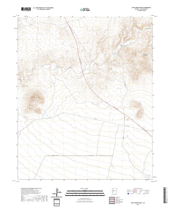
2021 Map of Date Creek Ranch
USGS Topo · Published 2021About this map
Date Creek Ranch sits at the heart of this desert landscape in western Yavapai County, where the high desert meets the rugged Date Creek Mountains. The geography is defined by the ephemeral flow of Date Creek, which winds through the northern sections of the map, carving through the terrain near Black Mtn. This modern survey illustrates the sparse but vital infrastructure of the region, showing how access routes like the Joshua Tree Pkwy and Alamo Rd facilitate movement through this arid environment. The presence of water management features such as Possum Tank and Wood Spurger Tank highlights the enduring importance of water security for ranching operations in the Arizona interior. Researchers can trace the intersection of old ranching roads, including Date Creek Ranch Rd, against the natural topography of the basin and range province.
Find a feature on this map
16 named features on this map. Tap any name to fly to it.
Don’t see what you’re looking for? This feature index may not catch every label — zoom into the map to look around manually.
Map Details
Editions of this 2021 Date Creek Ranch Map
This is the sole edition of this map. No revisions or reprints were ever made.
Other maps of this area

1887 · Prescott
USGS Topo · 1:250,000

1892 · Prescott
USGS Topo · 1:250,000

1903 · Congress
USGS Topo · 1:125,000

1904 · Congress
USGS Topo · 1:125,000

1923 · Signal
USGS Topo · 1:250,000

1942 · Signal
USGS Topo · 1:250,000

1950 · Prescott
USGS Topo · 1:250,000

1954 · Prescott
USGS Topo · 1:250,000

1958 · Prescott
USGS Topo · 1:250,000

1959 · Prescott
USGS Topo · 1:250,000