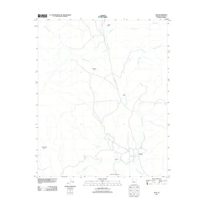
2011 Map of Date
USGS Topo · Published 2011About this map
Date and the nearby settlement of Hawkins anchor this 2011 survey of the high desert landscape in Yavapai County. The terrain is defined by a network of drainage systems, including the North Fork Date Creek and South Fork Date Creek, which flow through the foothills of the Date Creek Mountains. Water sources like Billingsley Spring and Camp Date Creek suggest the critical importance of reliable hydration in this arid environment, likely influencing the placement of original ranching outposts and roads such as S Date Creek Rd. The geography transitions from the open expanse of Sunflower Flat to the more confined passages of Black Canyon and Cottonwood Canyon. These maps reveal how modern infrastructure follows the same natural contours that dictated early travel and settlement in the Arizona interior.
Find a feature on this map
17 named features on this map. Tap any name to fly to it.
Don’t see what you’re looking for? This feature index may not catch every label — zoom into the map to look around manually.
Map Details
Editions of this 2011 Date Map
This is the sole edition of this map. No revisions or reprints were ever made.
Other maps of this area

1887 · Prescott
USGS Topo · 1:250,000

1892 · Prescott
USGS Topo · 1:250,000

1903 · Congress
USGS Topo · 1:125,000

1904 · Congress
USGS Topo · 1:125,000

1923 · Signal
USGS Topo · 1:250,000

1942 · Signal
USGS Topo · 1:250,000

1950 · Prescott
USGS Topo · 1:250,000

1954 · Prescott
USGS Topo · 1:250,000

1958 · Prescott
USGS Topo · 1:250,000

1959 · Prescott
USGS Topo · 1:250,000