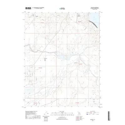
2018 Map of Daulton
USGS Topo · Published 2018About this map
Daulton sits at the northern edge of this Madera County landscape, where the foothills meet the irrigation infrastructure of the San Joaquin Valley. The movement of water is the defining characteristic of this terrain, anchored by the Madera Canal and the reservoir at Hensley Lake. The Fresno River and its South Fork wind through the center, feeding into Madera Lake and the China Slough. These water systems supported the agricultural development of the region, evident in the network of rural roads like Daulton Road and River Road. Small aviation hubs, including Daulton Airport and the Yosemite Hidden Lake Ranch Airport, suggest the varied land use of the late 20th century. The topography is marked by distinct rises like Rabbit Hill, overlooking the intricate drainage of Daulton Creek and Dry Creek.
Find a feature on this map
53 named features on this map. Tap any name to fly to it.
Don’t see what you’re looking for? This feature index may not catch every label — zoom into the map to look around manually.
Map Details
Editions of this 2018 Daulton Map
This is the sole edition of this map. No revisions or reprints were ever made.
Other maps of this area

1912 · Mariposa
USGS Topo · 1:125,000

1919 · Raynor Creek
USGS Topo · 1:31,680

1919 · Little Table Mountain
USGS Topo · 1:31,680

1920 · Kismet
USGS Topo · 1:31,680

1921 · Daulton
USGS Topo · 1:31,680

1922 · Lanes Bridge
USGS Topo · 1:31,680

1922 · Gregg
USGS Topo · 1:31,680

1922 · Madera
USGS Topo · 1:31,680

1942 · Raymond
USGS Topo · 1:62,500

1942 · Daulton
USGS Topo · 1:24,000