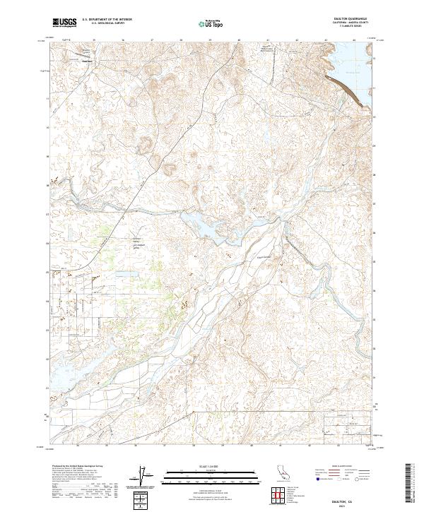
2021 Map of Daulton
USGS Topo · Published 2021About this map
Daulton serves as a primary local landmark in this part of Madera County, situated near the intersection of Daulton Rd and several seasonal watercourses. The landscape is defined by the hydrologic network of the Central Valley, where the Fresno River and its S Fork Fresno River wind through the terrain alongside the engineered Madera Canal. Small aviation hubs like the Daulton Airport and the Yosemite Hidden Lake Ranch Airport reflect the utility of the open geography in the early 21st century.
Find a feature on this map
56 named features on this map. Tap any name to fly to it.
Don’t see what you’re looking for? This feature index may not catch every label — zoom into the map to look around manually.
Map Details
Editions of this 2021 Daulton Map
This is the sole edition of this map. No revisions or reprints were ever made.
Other maps of this area

1912 · Mariposa
USGS Topo · 1:125,000

1919 · Raynor Creek
USGS Topo · 1:31,680

1919 · Little Table Mountain
USGS Topo · 1:31,680

1920 · Kismet
USGS Topo · 1:31,680

1921 · Daulton
USGS Topo · 1:31,680

1922 · Lanes Bridge
USGS Topo · 1:31,680

1922 · Gregg
USGS Topo · 1:31,680

1922 · Madera
USGS Topo · 1:31,680

1942 · Raymond
USGS Topo · 1:62,500

1942 · Daulton
USGS Topo · 1:24,000