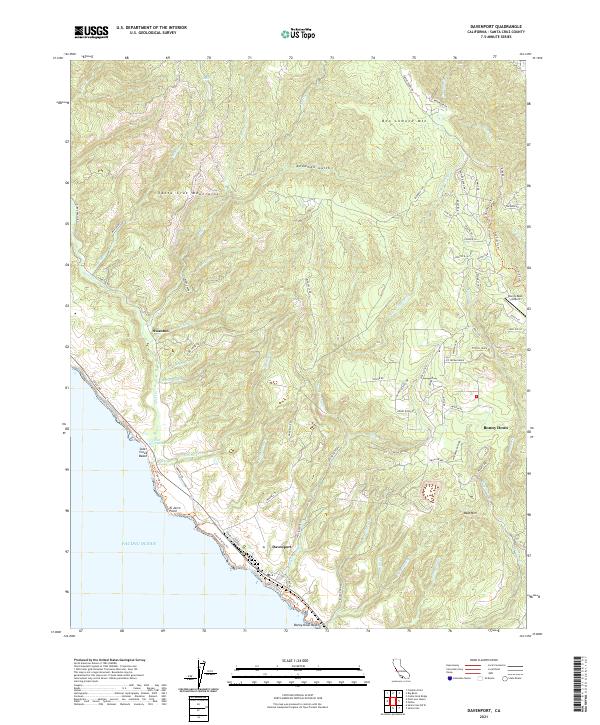
2021 Map of Davenport
USGS Topo · Published 2021About this map
The coastal bluffs and deep canyons of Santa Cruz County define this 2021 survey, centered on the historic cement-producing village of Davenport. The landscape transitions sharply from the shoreline at El Jarro Point and Bonny Doon Beach to the steep rises of Ben Lomond Mtn and the Santa Cruz Mountains. This geography dictates a settlement pattern concentrated along ridge-top roads like Empire Grade Rd and Ice Cream Grade, or tucked into small agricultural pockets like Swanton.
Find a feature on this map
86 named features on this map. Tap any name to fly to it.
Don’t see what you’re looking for? This feature index may not catch every label — zoom into the map to look around manually.
Map Details
Editions of this 2021 Davenport Map
This is the sole edition of this map. No revisions or reprints were ever made.
Other maps of this area

1902 · Santa Cruz
USGS Topo · 1:125,000

1940 · Ano Nuevo
USGS Topo · 1:62,500

1941 · Ano Nuevo Pt.
USGS Topo · 1:62,500

1942 · Ano Nuevo
USGS Topo · 1:62,500

1947 · San Francisco
USGS Topo · 1:250,000

1948 · Santa Cruz
USGS Topo · 1:250,000

1948 · San Francisco
USGS Topo · 1:250,000

1948 · Ano Nuevo
USGS Topo · 1:62,500
1954 · Santa Cruz
USGS Topo · 1:24,000

1955 · San Francisco
USGS Topo · 1:250,000