
1948 Map of Ano Nuevo
USGS Topo · Published 1961About this map
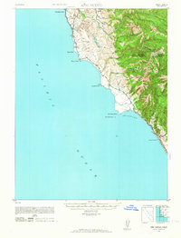
Pigeon Point and its neighboring headlands define this stretch of the California coast as it appeared during the late 1930s and early 1940s. The landscape is characterized by steep coastal bluffs and a series of westward-draining waterways, including Butano Creek and Arroyo de los Frijoles, which feed into coastal water bodies like Bean Hollow Lake and Lake Lucerne.
Find a feature on this map
28 named features on this map. Tap any name to fly to it.
Don’t see what you’re looking for? This feature index may not catch every label — zoom into the map to look around manually.
Map Details
Editions of this 1948 Ano Nuevo Map
2 editions found
Other maps of this area

1897 · Palo Alto
USGS Topo · 1:62,500

1899 · Palo Alto
USGS Topo · 1:62,500

1902 · Santa Cruz
USGS Topo · 1:125,000

1940 · Halfmoon Bay
USGS Topo · 1:62,500

1940 · Ano Nuevo
USGS Topo · 1:62,500

1941 · Ano Nuevo Pt.
USGS Topo · 1:62,500

1941 · Palo Alto
USGS Topo · 1:62,500

1942 · Ano Nuevo
USGS Topo · 1:62,500

1943 · Palo Alto
USGS Topo · 1:62,500

1943 · Halfmoon Bay
USGS Topo · 1:62,500