
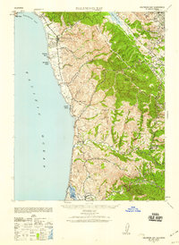
1940 Map of Halfmoon Bay
USGS Topo · Published 1940About this map
Coastal settlements and rural ranching operations define the San Mateo shoreline just before World War II. The landscape transitions from the Pacific bluffs of Pillar Point and Halfmoon Bay into the steep ridges of the Santa Cruz Mountains. Coastal life is anchored by small communities like San Gregorio and Pescadero, while the interior shows early 20th-century industry with the Westerly Oil Derrick and Middle Oil Derrick near Purisima Creek.
Find a feature on this map
65 named features on this map. Tap any name to fly to it.
Don’t see what you’re looking for? This feature index may not catch every label — zoom into the map to look around manually.
Map Details
Editions of this 1940 Halfmoon Bay Map
2 editions found
Other maps of this area

1892 · San Mateo
USGS Topo · 1:62,500

1896 · San Mateo
USGS Topo · 1:62,500

1897 · Palo Alto
USGS Topo · 1:62,500

1899 · Palo Alto
USGS Topo · 1:62,500

1899 · Haywards
USGS Topo · 1:62,500

1899 · San Mateo
USGS Topo · 1:62,500

1902 · Santa Cruz
USGS Topo · 1:125,000

1915 · San Mateo
USGS Topo · 1:62,500

1915 · Haywards
USGS Topo · 1:62,500

1939 · San Mateo
USGS Topo · 1:62,500