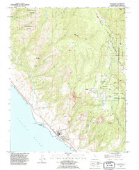
1991 Map of Davenport
USGS Topo · Published 1995About this map
Coastal industry and mountain topography meet on this coastline where the Cement Plant and its associated Conveyor system dominate the seaside at Davenport. The landscape is defined by the steep ascent from the Pacific Ocean toward Ben Lomond Mountain, marked by deep ravines like Deadman Gulch and San Vicente Creek. While the coastal terrace supports agricultural and industrial activity near Davenport Landing, the higher elevations are preserved within Big Basin Redwoods State Park and Henry Cowell Redwoods State Park.
Find a feature on this map
61 named features on this map. Tap any name to fly to it.
Don’t see what you’re looking for? This feature index may not catch every label — zoom into the map to look around manually.
Map Details
Editions of this 1991 Davenport Map
This is the sole edition of this map. No revisions or reprints were ever made.
Other maps of this area

1902 · Santa Cruz
USGS Topo · 1:125,000

1940 · Ano Nuevo
USGS Topo · 1:62,500

1941 · Ano Nuevo Pt.
USGS Topo · 1:62,500

1942 · Ano Nuevo
USGS Topo · 1:62,500

1947 · San Francisco
USGS Topo · 1:250,000

1948 · Santa Cruz
USGS Topo · 1:250,000

1948 · San Francisco
USGS Topo · 1:250,000

1948 · Ano Nuevo
USGS Topo · 1:62,500
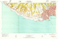
1954 · Santa Cruz
USGS Topo · 1:24,000

1955 · San Francisco
USGS Topo · 1:250,000