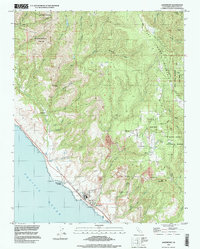
1997 Map of Davenport
USGS Topo · Published 1999About this map
Davenport anchors the coastline in this 1997 topographic study, where the industrial presence of the Cement Plant and a nearby Pier stand against the rising slopes of the Santa Cruz Mountains. The landscape transitions rapidly from the shore at Davenport Landing to the forested heights of Ben Lomond Mountain, a region defined by steep drainages like San Vicente Creek and Scott Creek. Evidence of early 20th-century utility and resource extraction is visible at the Big Creek Powerhouse (Site) and several inland Quarry sites.
Find a feature on this map
52 named features on this map. Tap any name to fly to it.
Don’t see what you’re looking for? This feature index may not catch every label — zoom into the map to look around manually.
Map Details
Editions of this 1997 Davenport Map
This is the sole edition of this map. No revisions or reprints were ever made.
Other maps of this area

1902 · Santa Cruz
USGS Topo · 1:125,000

1940 · Ano Nuevo
USGS Topo · 1:62,500

1941 · Ano Nuevo Pt.
USGS Topo · 1:62,500

1942 · Ano Nuevo
USGS Topo · 1:62,500

1947 · San Francisco
USGS Topo · 1:250,000

1948 · Santa Cruz
USGS Topo · 1:250,000

1948 · San Francisco
USGS Topo · 1:250,000

1948 · Ano Nuevo
USGS Topo · 1:62,500
1954 · Santa Cruz
USGS Topo · 1:24,000

1955 · San Francisco
USGS Topo · 1:250,000