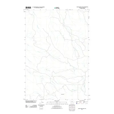
2011 Map of Davis Creek East
USGS Topo · Published 2011About this map
Saddle Butte rises as a prominent landmark in this eastern Montana landscape, anchoring a drainage network of seasonal and perennial waterways. This 2011 survey by the U.S. Geological Survey details the remote character of Carter County, where the terrain is defined by the winding paths of Whitetail Creek and South Spring Creek. The map documents a sparsely developed area, with Ridge Rd serving as one of the few named transportation corridors through the open country. Water remains the primary geographical feature, with Dry Creek and its tributary South Dry Creek cutting across the central plains, eventually meeting with Davis Creek and Cabin Creek to the south and east. The concentration of named coulees and creek beds reflects the importance of water resources in this ranching-oriented region of the Great Plains.
Find a feature on this map
9 named features on this map. Tap any name to fly to it.
Don’t see what you’re looking for? This feature index may not catch every label — zoom into the map to look around manually.
Map Details
Editions of this 2011 Davis Creek East Map
This is the sole edition of this map. No revisions or reprints were ever made.
Other maps of this area

1954 · Ekalaka
USGS Topo · 1:250,000

1956 · Ekalaka
USGS Topo · 1:250,000

1958 · Ekalaka
USGS Topo · 1:250,000

1965 · Ekalaka
USGS Topo · 1:250,000

1979 · W L Butte
USGS Topo · 1:24,000

1979 · Dutchman Creek
USGS Topo · 1:24,000

1979 · Blacktail Creek SE
USGS Topo · 1:24,000

1979 · Blacktail Creek SW
USGS Topo · 1:24,000

1979 · Beaver Flats South
USGS Topo · 1:24,000

1979 · Chalk Buttes
USGS Topo · 1:24,000