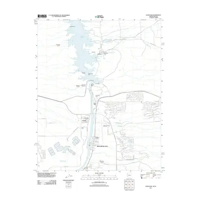
2011 Map of Davis Dam
USGS Topo · Published 2011About this map
Lake Mohave dominates the northern reaches of this Colorado River corridor, where the impounded waters fill a labyrinth of named inlets including Sour Dough Cove, Jackrabbit Cove, and Navajo Cove. At the heart of the region, the Davis Dam regulates the river's flow, flanked by the Forbay Bridge and providing the power and water infrastructure that supported the 21st-century growth of Bullhead City and Laughlin. The map details the transition from industrial utility to recreation, noting the Mohave Generating Station Reservoir alongside the Lake Mohave Resort and Katherine Landing. For researchers, the survey captures the area's intricate canyon geography, from Grapevine Canyon to Secret Pass Canyon, and identifies critical local service hubs like the Laughlin Rural Branch Post Office and the Laughlin/Bullhead City Airport.
Find a feature on this map
95 named features on this map. Tap any name to fly to it.
Don’t see what you’re looking for? This feature index may not catch every label — zoom into the map to look around manually.
Map Details
Editions of this 2011 Davis Dam Map
This is the sole edition of this map. No revisions or reprints were ever made.
Other maps of this area

1886 · Camp Mohave
USGS Topo · 1:250,000

1892 · Camp Mohave
USGS Topo · 1:250,000

1926 · Mohave City
USGS Topo · 1:96,000

1942 · Camp Mohave
USGS Topo · 1:250,000

1947 · Kingman
USGS Topo · 1:250,000

1948 · Kingman
USGS Topo · 1:250,000

1950 · Davis Dam
USGS Topo · 1:62,500

1952 · Davis Dam
USGS Topo · 1:62,500

1954 · Kingman
USGS Topo · 1:250,000

1955 · Kingman
USGS Topo · 1:250,000