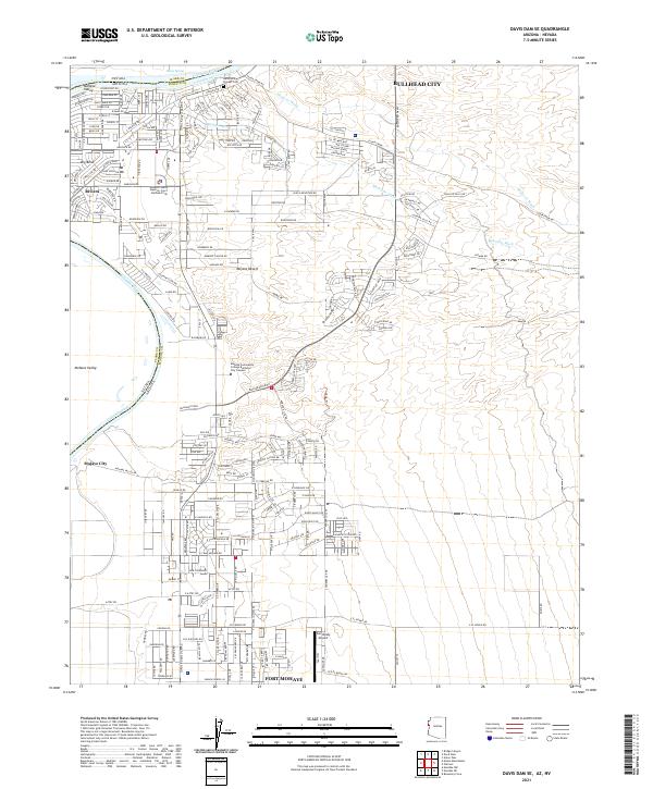
2021 Map of Davis Dam SE
USGS Topo · Published 2021About this map
Bullhead City and the surrounding riverfront communities define this stretch of the Colorado River as it winds along the border of Nevada and Arizona. The map details the dense suburban expansion into the Mojave Desert, where extensive residential networks like Riviera and Mohave City spread eastward from the riverbank. Significant local infrastructure is evident, including the Mohave Community College Bullhead City Campus and the Sun Valley Airport, reflecting the region's modern development as a hub for education and transportation.
Find a feature on this map
58 named features on this map. Tap any name to fly to it.
Don’t see what you’re looking for? This feature index may not catch every label — zoom into the map to look around manually.
Map Details
Editions of this 2021 Davis Dam SE Map
This is the sole edition of this map. No revisions or reprints were ever made.
Other maps of this area

1886 · Camp Mohave
USGS Topo · 1:250,000

1892 · Camp Mohave
USGS Topo · 1:250,000

1903 · Needles
USGS Topo · 1:125,000

1904 · Needles Special
USGS Topo · 1:125,000

1926 · Mohave City
USGS Topo · 1:96,000

1942 · Camp Mohave
USGS Topo · 1:250,000

1947 · Kingman
USGS Topo · 1:250,000

1948 · Kingman
USGS Topo · 1:250,000

1950 · Davis Dam
USGS Topo · 1:62,500

1950 · Needles
USGS Topo · 1:62,500