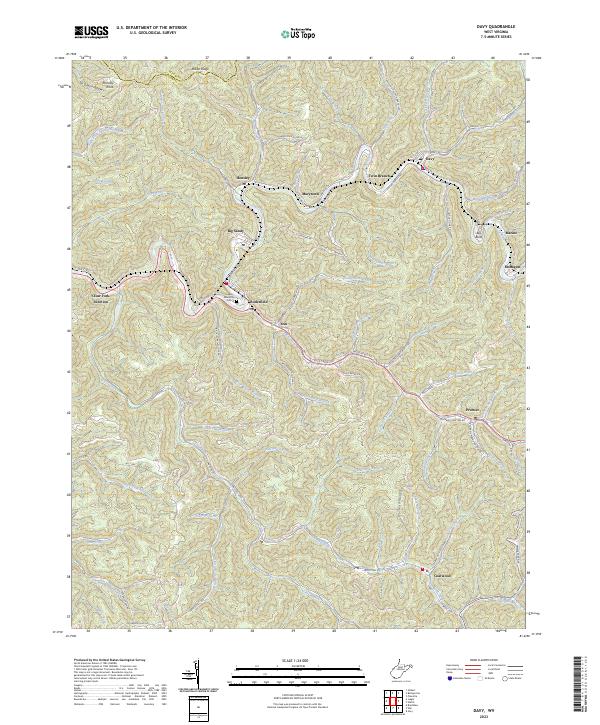
2023 Map of Davy
USGS Topo · Published 2023About this map
Coalwood and Davy anchor this detailed study of McDowell County's winding valley communities, where the geography of the southern West Virginia coalfields is clearly visible. The landscape is defined by the sinuous path of the Tug Fork and Clear Fork, which dictate the placement of settlements like Roderfield, Marytown, and Big Sandy. Steep ridges such as Indian Ridge and Hensley Knob separate these narrow valleys, illustrating the topographic constraints on local development.
Find a feature on this map
93 named features on this map. Tap any name to fly to it.
Don’t see what you’re looking for? This feature index may not catch every label — zoom into the map to look around manually.
Map Details
Editions of this 2023 Davy Map
This is the sole edition of this map. No revisions or reprints were ever made.
Other maps of this area

1891 · Tazewell
USGS Topo · 1:125,000

1891 · Oceana
USGS Topo · 1:125,000

1893 · Oceana
USGS Topo · 1:125,000

1895 · Tazewell
USGS Topo · 1:125,000

1897 · Tazewell
USGS Topo · 1:125,000

1898 · Oceana
USGS Topo · 1:125,000

1909 · Gilbert
USGS Topo · 1:48,000

1910 · Pineville
USGS Topo · 1:48,000

1910 · Iaeger
USGS Topo · 1:48,000

1912 · Gilbert
USGS Topo · 1:62,500