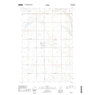
2020 Map of Dazey
USGS Topo · Published 2020About this map
The small town of Dazey serves as the focal point for this section of the North Dakota prairie, situated just south of the Griggs Co Barnes Co line. This agrarian landscape is defined by its rectilinear grid of section roads and numerous small depressions and sloughs, common to the glacial terrain of the region. The settlement is compact, centered around 4th Ave and 5th St, with the Dazey Cem located just to the south. To the east, the terrain descends toward the valley of Baldhill Creek, which winds through the eastern edge of the quadrangle. Significant water bodies like Hanson Lake and Lake Benson dot the landscape, providing essential landmarks in this open country. The presence of Bryn Airport east of the town site reflects the continued importance of regional aviation in maintaining connectivity across the sparsely populated northern plains.
Find a feature on this map
33 named features on this map. Tap any name to fly to it.
Don’t see what you’re looking for? This feature index may not catch every label — zoom into the map to look around manually.
Map Details
Editions of this 2020 Dazey Map
This is the sole edition of this map. No revisions or reprints were ever made.
Other maps of this area

1952 · New Rockford
USGS Topo · 1:250,000

1956 · New Rockford
USGS Topo · 1:250,000

1961 · Leal
USGS Topo · 1:24,000

1961 · Baldhill Dam
USGS Topo · 1:24,000

1961 · Revere
USGS Topo · 1:24,000

1961 · Hannaford
USGS Topo · 1:24,000

1961 · Wimbledon NE
USGS Topo · 1:24,000

1961 · Rogers
USGS Topo · 1:24,000

1961 · Dazey NE
USGS Topo · 1:24,000

1961 · Dazey
USGS Topo · 1:24,000