Old Maps of Griggs County, North Dakota
Explore 179 old maps of Griggs County, spanning from 1900 to today. These high-resolution historic maps reveal how streets, neighborhoods, landmarks, and natural features evolved over time — perfect for genealogy, metal detecting, research, and local history exploration.
What you can do with these maps:
- See how Griggs County changed over time: Compare historical maps to modern-day views to trace roads, homesites, rail lines & more.
- View detailed metadata: Each map includes creators, publishers, year, scale, and archive source.
- Overlay maps with satellite & LiDAR: Visualize the past alongside modern tools to explore terrain & human change.
- Trusted historical sources: Maps sourced from the USGS, Library of Congress, and other archives.
- Access maps your way: View online, download high-res files, or order prints for personal or research use.
Start exploring old maps of Griggs County to uncover forgotten places, hidden landmarks, and the deep history beneath your feet.
Griggs County, ND maps
(179)- 1900 Map of Pingree
 1900 Pingree1900 Print · USGSStutsman and Foster counties come alive in the final years of the nineteenth century as railroads began to stitch together the vast prairie. Researchers can trace the early rail stops at Pingree, Kensal, and Buchanan alongside the waters of Jim Lake and Spiritwood Lake.2 unique versions available
 - 1951 Map of Glenfield, 1982 Print
 1951 Glenfield1982 Print · USGSMid-century Foster County comes into focus in this survey of the prairie landscape during the early 1950s. Genealogists and local historians can trace the hub of Glenfield, the Great Northern rail line, and rural landmarks like School No 1.
 - 1952 Map of Grand Forks, 1967 Print
 1952 Grand Forks1967 Print · USGSThe Red River Valley in the early fifties is shown here at the height of its rail-and-river agricultural economy. Researchers can locate small-town landmarks like the Pleasant View School, the Immanuel Lutheran Church, and trace the path of the Soo Line Railroad.3 unique versions available
 - 1952 Map of New Rockford, 1968 Print
 1952 New Rockford1968 Print · USGSThe North Dakota prairie during the mid-1950s was a landscape of rail-dependent farm towns and vast wildlife refuges. Genealogists and historians can trace the foundations of local communities at Fort Totten Indian Agenc, Concordia Lutheran Church, and the Bowdon Country Church and Cemetery.3 unique versions available
 - 1956 Map of New Rockford
 1956 New Rockford1956 Print · USGSMid-century central North Dakota is captured here as a landscape of prairie rail towns and vast wildlife refuges. Trace family roots at the Bowdon Country Church and Cemetery or locate the old St Michael Mission School and Fort Totten.
 - 1956 Map of Grand Forks
 1956 Grand Forks1956 Print · USGSThe Red River Valley in the mid-fifties is captured here as a thriving corridor of grain elevators and rail-linked towns along the North Dakota and Minnesota border. Researchers can trace historic church sites like Immanuel Lutheran Church, vanished rail stops at Tilde Junction, and the boundaries of the White Earth Indian Reservation.
 - 1961 Map of McHenry, 1963 Print
 1961 McHenry1963 Print · USGSMcHenry and the surrounding prairie of Foster and Eddy Counties are captured here in the early sixties as a settled agricultural and rail landscape. Researchers can trace the Northern Pacific line into the village of McHenry and locate the historic Bethlehem Cem.
 - 1961 Map of Kloten NW, 1963 Print
 1961 Kloten NW1963 Print · USGSThe Sheyenne River valley and the heights of Pilot Mound define this North Dakota landscape in the early sixties. Genealogists can locate rural landmarks like Norway Ch and New Luther Valley Cem along the Nelson and Griggs county border.
 - 1961 Map of Binford, 1963 Print
 1961 Binford1963 Print · USGSGriggs County agriculture and conservation meet in the early 1960s, centered on the rail-connected town of Binford. Trace family roots and local landmarks through several rural burial grounds like Bethany Cem and the sprawling Sibley Lake National Wildlife Refuge.
 - 1961 Map of Cooperstown East, 1963 Print
 1961 Cooperstown East1963 Print · USGSGriggs County enters the 1960s with the expanding waters of the Sheyenne River valley and the growth of the county seat. Researchers can locate the Cooperstown Cem, the Fairground, and the specific engineering of the Ueland Dam.2 unique versions available
 - 1961 Map of Jessie, 1963 Print
 1961 Jessie1963 Print · USGSGriggs County prairie life is captured here in the early sixties, showing the vital rail-and-river network of the eastern plains. Genealogists can locate family landmarks like the West Prairie Ch, St Lawrence Cem, and the high ground of Pilot Mound.2 unique versions available
 - 1961 Map of Sutton, 1963 Print
 1961 Sutton1963 Print · USGSGriggs County agriculture and rail transport intersect in the early 1960s around the prairie settlement of Sutton. Researchers can trace the path of the Great Northern railroad and the winding Baldhill Creek through Kingsley and Mabel townships.
 - 1961 Map of Johnson Lake, 1963 Print
 1961 Johnson Lake1963 Print · USGSPrairie potholes and the Johnson Lake National Wildlife Refuge define this rural Eddy County landscape in the early sixties. Genealogists can locate Gethsemane Ch, its nearby Cem, and the Community Hall among the farms of Colvin and Paradise.2 unique versions available
 - 1961 Map of Revere, 1963 Print
 1961 Revere1963 Print · USGSGriggs County prairie life in the early sixties is centered on the Great Northern rail line and the tiny settlement of Revere. Genealogists and local historians can locate the Eidfjord Ch, find the grounds of School No 2, and trace the meandering Baldhill Creek.
 - 1961 Map of Wimbledon, 1963 Print
 1961 Wimbledon1963 Print · USGSWimbledon serves as a vital rail junction on the North Dakota prairie during the early sixties. Genealogists and local historians can trace the intersection of the Midland Continental and Soo Line railroads near St Boniface Cem and Mud Lake.2 unique versions available
 - 1961 Map of Hannaford, 1963 Print
 1961 Hannaford1963 Print · USGSIn the early sixties, the rail junctions and prairie townships of Griggs County remained vital links in the local grain economy. Researchers can trace the path of Baldhill Creek past Hannaford, locating Walum and family-history sites like Lyster Cem.
 - 1961 Map of Binford NE, 1963 Print
 1961 Binford NE1963 Print · USGSNelson and Griggs Counties are shown here in the early sixties, a time when the prairie was dotted with small parish churches and seasonal wetlands. Genealogists and local historians can locate Bethlehem Ch, Sheyenne Ch, and the waterside Red Willow Camp.
 - 1961 Map of Wimbledon NE, 1963 Print
 1961 Wimbledon NE1963 Print · USGSThe Griggs and Barnes County line in the early sixties showcases a classic North Dakota township system defined by isolated farmsteads and prairie wetlands. Local historians can trace early schoolhouse sites like Pierce Sch and Laketown Sch or industrial Gravel Pits.
 - 1961 Map of Cooperstown West, 1963 Print
 1961 Cooperstown West1963 Print · USGSGriggs County prairie life in the early sixties is centered on the railroad corridor and organized township lines. Genealogists can trace property locations near Cooperstown and Shepard, or locate landmarks like Lake Five and the local Gravel Pits.2 unique versions available
 - 1961 Map of Binford NW, 1963 Print
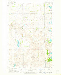 1961 Binford NW1963 Print · USGSThe glacial prairie of central North Dakota is captured here in the early sixties, showing the vital connection between water and rural settlement. Genealogists and local historians can locate early burial sites such as Bergen Ch Cem and trace the shorelines of Red Willow Lake and Ottofy Lake.
 - 1961 Map of Sutton NE, 1963 Print
 1961 Sutton NE1963 Print · USGSGriggs County agriculture and rural life are captured here in the early sixties, showing the structured township system of the North Dakota plains. Researchers can pinpoint family-linked sites like Hartman Memorial Cem, Zion Ch, and the banks of Baldhill Creek.
 - 1961 Map of Mose, 1963 Print
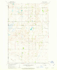 1961 Mose1963 Print · USGSGriggs County and its surrounding prairie landscape are documented here in the early sixties, as the railway still shaped local life. Researchers can find old burial sites like Naroen Cem, the settlement at Mose, and the waters of Hoot-E-Too Lake.
 - 1961 Map of Sutton SW, 1963 Print
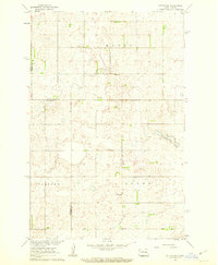 1961 Sutton SW1963 Print · USGSGriggs County and the neighboring townships of Dover and Corinne are captured in the early sixties as the agricultural landscape of the Missouri River Basin matured. Genealogists and local historians can trace family land via field lines and locate the Mabel Cem, Holland Ch, and the local Townhall.
 - 1961 Map of Dazey NE, 1963 Print
 1961 Dazey NE1963 Print · USGSThe Sheyenne River valley in Barnes County appears here just as the landscape was adapting to the creation of Lake Ashtabula. Researchers can trace the historical Sibley Trail and locate rural landmarks like St Marys Ch, Sunnyside Cem, and School No 25.
 - 1961 Map of Dazey, 1963 Print
 1961 Dazey1963 Print · USGSThe town of Dazey sits at a rail junction in eastern North Dakota during the early 1960s, surrounded by a landscape of prairie potholes and farmsteads. Researchers can trace the Northern Pacific rail line and locate landmarks like the Dazey Cemetery and Lake Benson.
Showing maps 1-25 of 179
Top cities of Griggs County
Frequently asked questions
- What are the different types of historical maps available for Griggs County?
- What is the oldest map of Griggs County?
- Where can I purchase historical maps of Griggs County for my home or office?
- Where can I download high-res historical maps of Griggs County?
- Are there historical topographic maps available for Griggs County?
- Is there historical aerial imagery available for Griggs County?
- Where are historical maps of Griggs County sourced from?