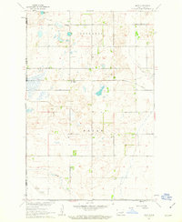
1961 Map of Mose
USGS Topo · Published 1963About this map
Northern Pacific rail lines cut through the center of this North Dakota landscape during the early 1960s, anchoring the small settlement of Mose. The area is characterized by a high density of prairie potholes and small water bodies, including the uniquely named Hoot-E-Too Lake in the northwest. This survey, conducted as part of the Department of the Interior's Missouri River Basin development, reveals a rural economy organized around the townships of Rosendal and Bryan. Local heritage is well-preserved through several small burial grounds and houses of worship, such as Zion Ch Cem and Naroen Cem, which serve as vital markers for genealogical research. In the southern portion of the quadrangle, Baldhill Creek winds through the terrain, while various Gravel Pits indicate localized extraction activities supporting the region's road network.
Find a feature on this map
14 named features on this map. Tap any name to fly to it.
Don’t see what you’re looking for? This feature index may not catch every label — zoom into the map to look around manually.
Map Details
Editions of this 1961 Mose Map
This is the sole edition of this map. No revisions or reprints were ever made.
Other maps of this area

1900 · Pingree
USGS Topo · 1:125,000

1951 · Glenfield
USGS Topo · 1:24,000

1952 · New Rockford
USGS Topo · 1:250,000

1956 · New Rockford
USGS Topo · 1:250,000

1961 · McHenry
USGS Topo · 1:24,000

1961 · Binford
USGS Topo · 1:24,000

1961 · Sutton
USGS Topo · 1:24,000

1961 · Johnson Lake
USGS Topo · 1:24,000

1961 · Binford NE
USGS Topo · 1:24,000
1961 · Binford NW
USGS Topo · 1:24,000