
1961 Map of Johnson Lake
USGS Topo · Published 1963About this map
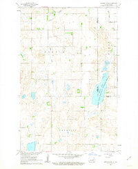
Johnson Lake National Wildlife Refuge anchors the eastern edge of this 1961 field-checked landscape, straddling the border between Eddy and Nelson Counties. The terrain is characterized by the prairie pothole geography of the Missouri River Basin, where significant water features like Johnson Lake and Kelly Slough define the local ecology. The township of Colvin is bisected by Colvin Creek, while the southern reaches fall within Paradise. Local social life and faith in this rural community are represented by the Community Hall in the north and Gethsemane Ch with its adjacent Cem further east. The map detail extends to agricultural and industrial markers, including several Gravel Pit sites and a network of red dashed lines indicating fence and field boundaries visible during the 1958 aerial survey. This record provides a clear view of the mid-century township boundaries of Forde and its neighbors before further modern development.
Find a feature on this map
14 named features on this map. Tap any name to fly to it.
Don’t see what you’re looking for? This feature index may not catch every label — zoom into the map to look around manually.
Map Details
Editions of this 1961 Johnson Lake Map
2 editions found
Other maps of this area

1930 · Pekin
USGS Topo · 1:62,500

1930 · Hamar
USGS Topo · 1:62,500

1951 · Tolna
USGS Topo · 1:24,000

1951 · Pekin
USGS Topo · 1:62,500

1952 · New Rockford
USGS Topo · 1:250,000

1956 · New Rockford
USGS Topo · 1:250,000
1961 · Lake Coe
USGS Topo · 1:24,000

1961 · McHenry
USGS Topo · 1:24,000
1961 · Juanita
USGS Topo · 1:24,000
1961 · Binford NW
USGS Topo · 1:24,000