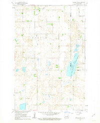
1961 Map of Johnson Lake
USGS Topo · Published 1978About this map
The Johnson Lake National Wildlife Refuge dominates the eastern half of this 1961 survey, straddling the boundary between Eddy and Nelson Counties. The landscape is characterized by the prairie pothole topography of the Missouri River Basin, where Johnson Lake and Kelly Slough provide critical habitat amidst the agricultural townships of Colvin and Paradise. The drainage pattern is defined by Colvin Creek as it meanders through the undulating terrain.
Find a feature on this map
13 named features on this map. Tap any name to fly to it.
Don’t see what you’re looking for? This feature index may not catch every label — zoom into the map to look around manually.
Map Details
Editions of this 1961 Johnson Lake Map
2 editions found
Other maps of this area

1930 · Pekin
USGS Topo · 1:62,500

1930 · Hamar
USGS Topo · 1:62,500

1951 · Tolna
USGS Topo · 1:24,000

1951 · Pekin
USGS Topo · 1:62,500

1952 · New Rockford
USGS Topo · 1:250,000

1956 · New Rockford
USGS Topo · 1:250,000
1961 · Lake Coe
USGS Topo · 1:24,000

1961 · McHenry
USGS Topo · 1:24,000
1961 · Juanita
USGS Topo · 1:24,000

1961 · Johnson Lake
USGS Topo · 1:24,000