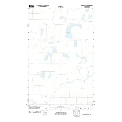
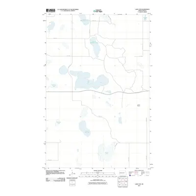
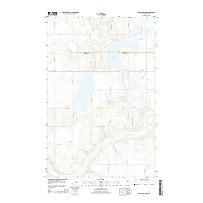
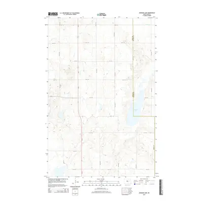
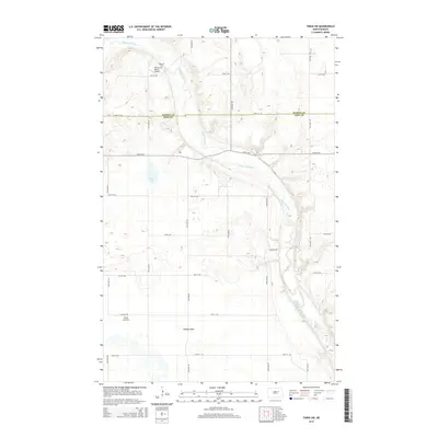
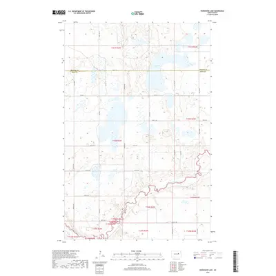
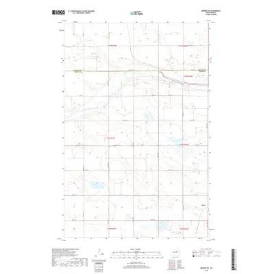
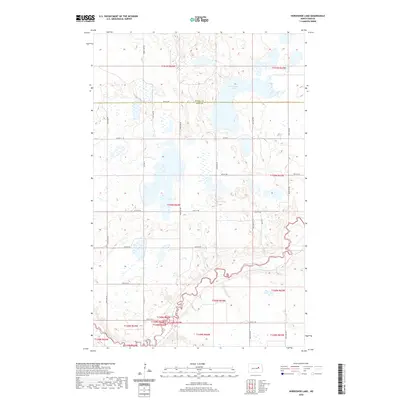
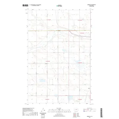
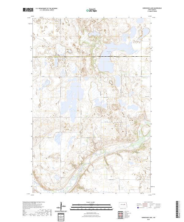
1951 Map of Horseshoe Lake
USGS Topo · Published 1952About this map
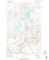
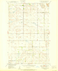
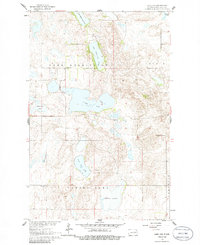
The Old Indian Reservation Boundary cuts across this 1951 landscape, marking a historical division just north of the meandering Sheyenne River. This portion of Eddy County is characterized by a dense network of glacial prairie potholes and larger water bodies like Wood Lake and the prominent Horseshoe Lake. The distribution of rural education is clearly visible through numbered district landmarks, including School No 2 and School No 3, alongside an instance of School No 3 (Abandoned) which suggests shifting populations in the post-war era. The terrain transitions from the high ground of Hillsdale and Tiffany toward the southern drainage of the Sheyenne, where the river valley creates a distinct breaks-and-coulee topography contrasted against the lake-dotted plains of Warwick.
Find a feature on this map
12 named features on this map. Tap any name to fly to it.
Don’t see what you’re looking for? This feature index may not catch every label — zoom into the map to look around manually.
Map Details
Editions of this 1951 Horseshoe Lake Map
This is the sole edition of this map. No revisions or reprints were ever made.
Historical Maps of Wood Lake District Through Time
57 maps found
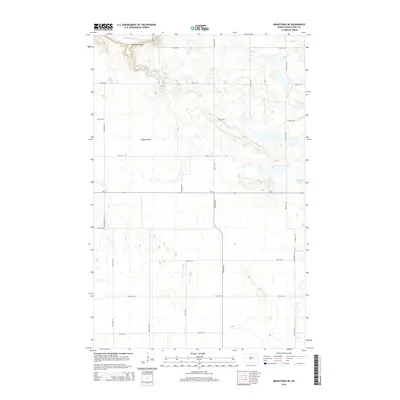
1944 Brantford
Eddy County, ND
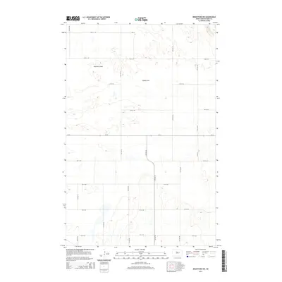
1946 Brantford
Eddy County, ND
1950 Brantford NE
Eddy County, ND
1950 Brantford NW
Eddy County, ND
1950 New Rockford NE
Eddy County, ND
1950 Oberon SW
Eddy County, ND
1950 Tokio SW
Eddy County, ND
1951 Horseshoe Lake
Eddy County, ND

1961 Johnson Lake
Eddy County, ND
1961 Lake Coe
Eddy County, ND
1962 Hamar
Eddy County, ND
1975 Tokio SW
Eddy County, ND
2011 Brantford NE
Eddy County, ND
2011 Brantford NW
Eddy County, ND
2011 Hamar
Eddy County, ND
2011 Horseshoe Lake
Eddy County, ND
2011 Johnson Lake
Eddy County, ND
2011 Lake Coe
Eddy County, ND
2011 New Rockford NE
Eddy County, ND
2011 Oberon SW
Eddy County, ND
2011 Tokio SW
Eddy County, ND
2014 Brantford NE
Eddy County, ND
2014 Brantford NW
Eddy County, ND
2014 Hamar
Eddy County, ND
2014 Horseshoe Lake
Eddy County, ND
2014 Johnson Lake
Eddy County, ND
2014 Lake Coe
Eddy County, ND
2014 New Rockford NE
Eddy County, ND
2014 Oberon SW
Eddy County, ND
2014 Tokio SW
Eddy County, ND
2017 Brantford NE
Eddy County, ND
2018 Brantford NW
Eddy County, ND
2018 Hamar
Eddy County, ND
2018 Horseshoe Lake
Eddy County, ND
2018 Johnson Lake
Eddy County, ND
2018 Lake Coe
Eddy County, ND
2018 New Rockford NE
Eddy County, ND
2018 Oberon SW
Eddy County, ND

2018 Tokio SW
Eddy County, ND
2020 Brantford NE
Eddy County, ND
2020 Brantford NW
Eddy County, ND
2020 Hamar
Eddy County, ND
2020 Horseshoe Lake
Eddy County, ND
2020 Johnson Lake
Eddy County, ND
2020 Lake Coe
Eddy County, ND
2020 New Rockford NE
Eddy County, ND
2020 Oberon SW
Eddy County, ND
2020 Tokio SW
Eddy County, ND
2024 Brantford NE
Eddy County, ND
2024 Brantford NW
Eddy County, ND
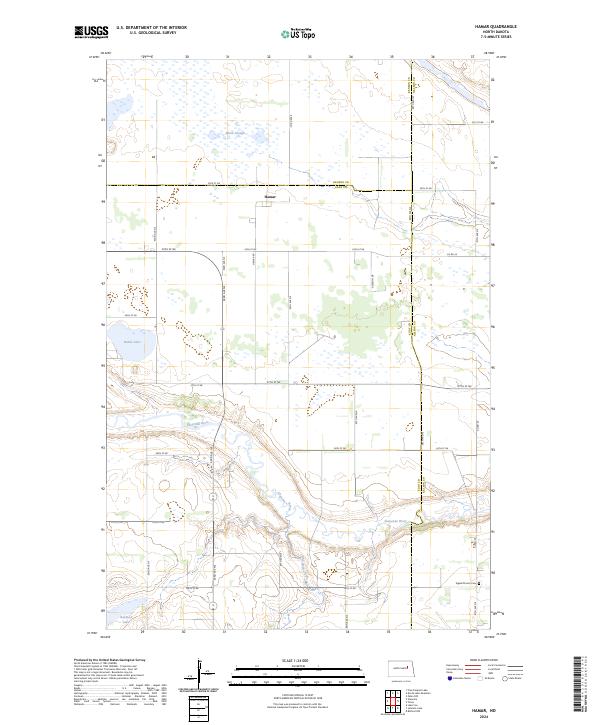
2024 Hamar
Eddy County, ND
2024 Horseshoe Lake
Eddy County, ND
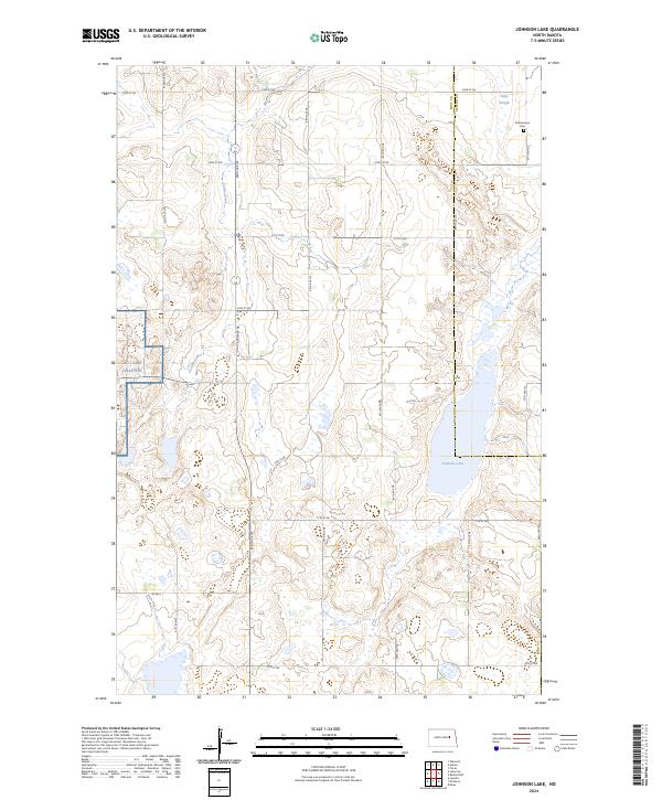
2024 Johnson Lake
Eddy County, ND
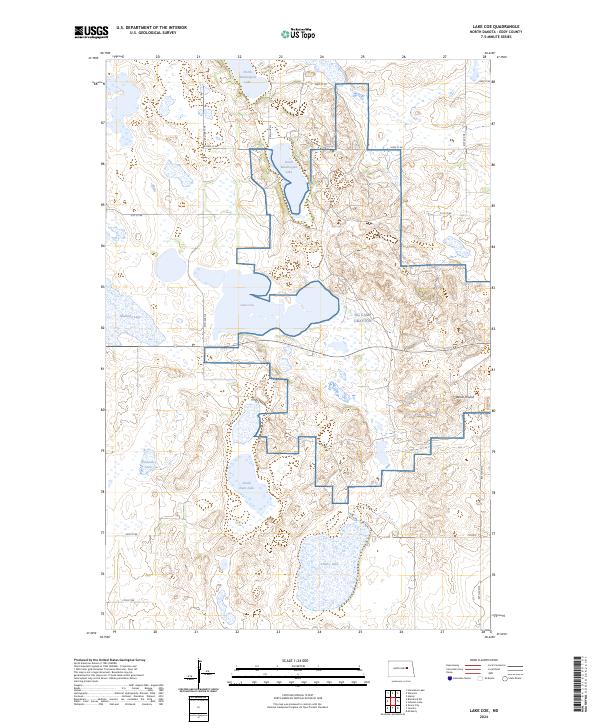
2024 Lake Coe
Eddy County, ND
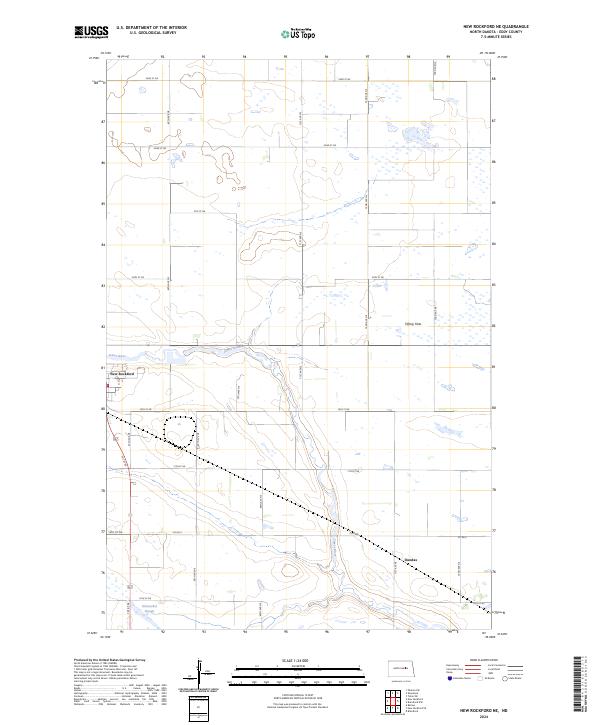
2024 New Rockford NE
Eddy County, ND
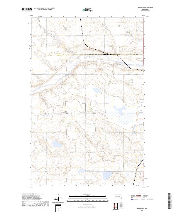
2024 Oberon SW
Eddy County, ND
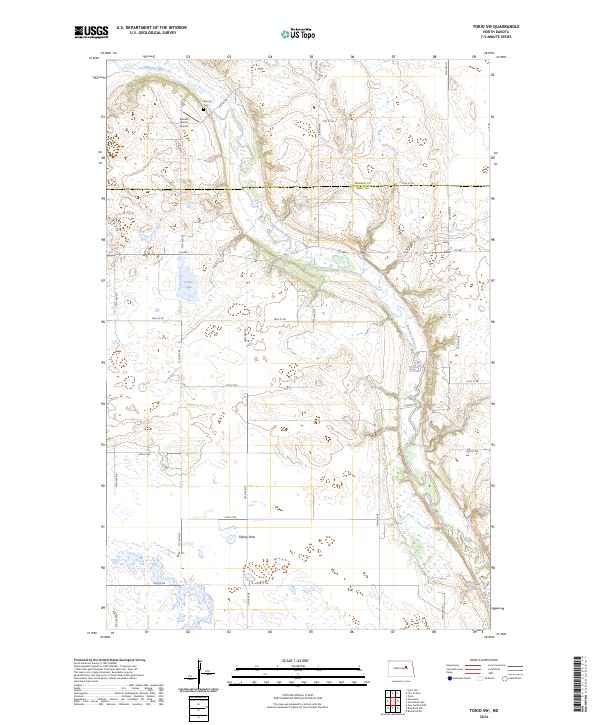
2024 Tokio SW
Eddy County, ND