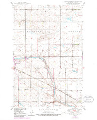
1950 Map of New Rockford NE
USGS Topo · Published 1986About this map
The James River snakes through the glacial landscape of Eddy County, serving as the central geographic feature for the surrounding townships of New Rockford, Sheldon, Superior, and Pleasant Prairie. This mid-century survey, updated in the 1980s, documents a rural landscape where education and transport were localized to small hubs. The settlement of New Rockford sits along the western edge, while the small community of Dundas is positioned further southeast along the Burlington Northern railroad line.
Find a feature on this map
17 named features on this map. Tap any name to fly to it.
Don’t see what you’re looking for? This feature index may not catch every label — zoom into the map to look around manually.
Map Details
Editions of this 1950 New Rockford NE Map
2 editions found
Other maps of this area

1928 · Tokio
USGS Topo · 1:62,500

1931 · Oberon
USGS Topo · 1:62,500

1931 · Tokio
USGS Topo · 1:62,500

1944 · Brantford
USGS Topo · 1:62,500

1946 · Brantford
USGS Topo · 1:62,500

1948 · New Rockford
USGS Topo · 1:62,500

1950 · New Rockford
USGS Topo · 1:24,000

1950 · New Rockford NE
USGS Topo · 1:24,000

1950 · Oberon SW
USGS Topo · 1:24,000

1950 · Brantford NW
USGS Topo · 1:24,000