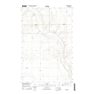
2014 Map of Tokio SW
USGS Topo · Published 2014About this map
The Sheyenne River meanders across this rural landscape at the border of Benson and Eddy counties. The terrain is characterized by the broad Tiffany Flats and the basin of Goose Lake, reflecting the glacial geography of the region. Local land use is documented through the presence of private aviation facilities like the Bourett Ranch Airport and Smith Airstrip, which serve the expansive agricultural tracts. For those tracing local history or family lineage, the Bourett Cem is a primary landmark situated near the river in the northern portion of the quadrangle. The grid of section roads, including 29th St NE and 77th Ave NE, illustrates the enduring structure of the Public Land Survey System that governs the prairie's development.
Find a feature on this map
22 named features on this map. Tap any name to fly to it.
Don’t see what you’re looking for? This feature index may not catch every label — zoom into the map to look around manually.
Map Details
Editions of this 2014 Tokio SW Map
This is the sole edition of this map. No revisions or reprints were ever made.
Other maps of this area

1928 · Tokio
USGS Topo · 1:62,500

1931 · Oberon
USGS Topo · 1:62,500

1931 · Tokio
USGS Topo · 1:62,500

1944 · Brantford
USGS Topo · 1:62,500

1946 · Brantford
USGS Topo · 1:62,500

1948 · New Rockford
USGS Topo · 1:62,500

1950 · New Rockford NE
USGS Topo · 1:24,000

1950 · Brantford NW
USGS Topo · 1:24,000

1950 · Sheyenne
USGS Topo · 1:24,000

1950 · Brantford NE
USGS Topo · 1:24,000